Distance from Plast to Troitsk
Distance between Plast and Troitsk is 58 kilometers (36 miles).
Driving distance from Plast to Troitsk is 80 kilometers (49 miles).
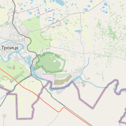
Distance Map Between Plast and Troitsk
Plast, Chelyabinsk, Russia ↔ Troitsk, Chelyabinsk, Russia = 36 miles = 58 km.


How far is it between Plast and Troitsk
Plast is located in Russia with (54.3691,60.8136) coordinates and Troitsk is located in Russia with (54.0979,61.5773) coordinates. The calculated flying distance from Plast to Troitsk is equal to 36 miles which is equal to 58 km.
If you want to go by car, the driving distance between Plast and Troitsk is 79.59 km. If you ride your car with an average speed of 112 kilometers/hour (70 miles/h), travel time will be 00 hours 42 minutes. Please check the avg. speed travel time table on the right for various options.
Difference between fly and go by a car is 22 km.
| City/Place | Latitude and Longitude | GPS Coordinates |
|---|---|---|
| Plast | 54.3691, 60.8136 | 54° 22´ 8.9040'' N 60° 48´ 48.9960'' E |
| Troitsk | 54.0979, 61.5773 | 54° 5´ 52.4400'' N 61° 34´ 38.2800'' E |
Estimated Travel Time Between Plast and Troitsk
| Average Speed | Travel Time |
|---|---|
| 30 mph (48 km/h) | 01 hours 39 minutes |
| 40 mph (64 km/h) | 01 hours 14 minutes |
| 50 mph (80 km/h) | 00 hours 59 minutes |
| 60 mph (97 km/h) | 00 hours 49 minutes |
| 70 mph (112 km/h) | 00 hours 42 minutes |
| 75 mph (120 km/h) | 00 hours 39 minutes |
Related Distances from Plast
| Cities | Distance |
|---|---|
| Plast to Asha | 324 km |
| Plast to Sim | 310 km |
| Plast to Bakal | 198 km |
| Plast to Trekhgornyy | 224 km |
| Plast to Kusa | 170 km |
Related Distances to Troitsk
| Cities | Distance |
|---|---|
| Andreyevskoye to Troitsk 2 | 55 km |
| Novogireyevo to Troitsk 2 | 61 km |
| Snezhinsk to Troitsk | 280 km |
| Krasnogorsk to Troitsk 2 | 50 km |
| Fryazevo to Troitsk 2 | 100 km |