Distance from Ploiesti to Suceava
Distance between Ploiesti and Suceava is 299 kilometers (186 miles).
Driving distance from Ploiesti to Suceava is 399 kilometers (248 miles).
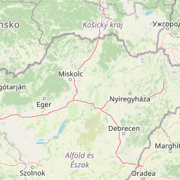
Distance Map Between Ploiesti and Suceava
Ploiesti, Romania ↔ Suceava, Romania = 186 miles = 299 km.


How far is it between Ploieşti and Suceava
Ploiesti is located in Romania with (44.95,26.0167) coordinates and Suceava is located in Romania with (47.6333,26.25) coordinates. The calculated flying distance from Ploiesti to Suceava is equal to 186 miles which is equal to 299 km.
If you want to go by car, the driving distance between Ploiesti and Suceava is 398.9 km. If you ride your car with an average speed of 112 kilometers/hour (70 miles/h), travel time will be 03 hours 33 minutes. Please check the avg. speed travel time table on the right for various options.
Difference between fly and go by a car is 100 km.
| City/Place | Latitude and Longitude | GPS Coordinates |
|---|---|---|
| Ploiesti | 44.95, 26.0167 | 44° 57´ 0.0000'' N 26° 1´ 0.0120'' E |
| Suceava | 47.6333, 26.25 | 47° 37´ 59.9880'' N 26° 15´ 0.0000'' E |
Estimated Travel Time Between Ploieşti and Suceava
| Average Speed | Travel Time |
|---|---|
| 30 mph (48 km/h) | 08 hours 18 minutes |
| 40 mph (64 km/h) | 06 hours 13 minutes |
| 50 mph (80 km/h) | 04 hours 59 minutes |
| 60 mph (97 km/h) | 04 hours 06 minutes |
| 70 mph (112 km/h) | 03 hours 33 minutes |
| 75 mph (120 km/h) | 03 hours 19 minutes |
Related Distances from Ploiesti
| Cities | Distance |
|---|---|
| Ploiesti to Targoviste | 52 km |
| Ploiesti to Ramnicu Valcea | 187 km |
| Ploiesti to Sibiu | 247 km |
| Ploiesti to Timisoara | 516 km |
| Ploiesti to Slatina | 187 km |
Related Distances to Suceava
| Cities | Distance |
|---|---|
| Bucharest to Suceava | 437 km |
| Iasi to Suceava | 144 km |
| Cluj Napoca to Suceava | 301 km |
| Botosani to Suceava | 44 km |
| Brasov to Suceava | 318 km |