Distance from Ponca City to Moore
Distance between Ponca City and Moore is 156 kilometers (97 miles).
Driving distance from Ponca City to Moore is 182 kilometers (113 miles).
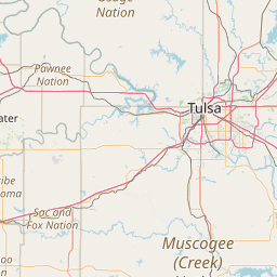
Distance Map Between Ponca City and Moore
Ponca City, Oklahoma City, United States ↔ Moore, Oklahoma City, United States = 97 miles = 156 km.


How far is it between Ponca City and Moore
Ponca City is located in United States with (36.707,-97.0856) coordinates and Moore is located in United States with (35.3395,-97.4867) coordinates. The calculated flying distance from Ponca City to Moore is equal to 97 miles which is equal to 156 km.
If you want to go by car, the driving distance between Ponca City and Moore is 181.51 km. If you ride your car with an average speed of 112 kilometers/hour (70 miles/h), travel time will be 01 hours 37 minutes. Please check the avg. speed travel time table on the right for various options.
Difference between fly and go by a car is 26 km.
| City/Place | Latitude and Longitude | GPS Coordinates |
|---|---|---|
| Ponca City | 36.707, -97.0856 | 36° 42´ 25.1280'' N 97° 5´ 8.1240'' W |
| Moore | 35.3395, -97.4867 | 35° 20´ 22.2360'' N 97° 29´ 12.1200'' W |
Estimated Travel Time Between Ponca City and Moore
| Average Speed | Travel Time |
|---|---|
| 30 mph (48 km/h) | 03 hours 46 minutes |
| 40 mph (64 km/h) | 02 hours 50 minutes |
| 50 mph (80 km/h) | 02 hours 16 minutes |
| 60 mph (97 km/h) | 01 hours 52 minutes |
| 70 mph (112 km/h) | 01 hours 37 minutes |
| 75 mph (120 km/h) | 01 hours 30 minutes |
Related Distances from Ponca City
| Cities | Distance |
|---|---|
| Ponca City to Ada | 237 km |
| Ponca City to Altus | 389 km |
| Ponca City to Ardmore | 323 km |
| Ponca City to Bartlesville | 112 km |
| Ponca City to Bethany 2 | 174 km |
| Ponca City to Bixby | 185 km |
| Ponca City to Broken Arrow | 174 km |
| Ponca City to Chickasha | 236 km |
| Ponca City to Claremore | 198 km |
| Ponca City to Del City | 169 km |
Related Distances to Moore
| Cities | Distance |
|---|---|
| Shawnee 2 to Moore | 64 km |
| Yukon to Moore | 42 km |
| New Bern to Mooresville | 424 km |
| Ponca City to Moore | 182 km |
| Morrisville to Mooresville | 226 km |
| Thomasville to Mooresville | 84 km |
| Tulsa to Moore | 183 km |
| Wilmington to Mooresville | 358 km |
| Muskogee to Moore | 225 km |
| Sand Springs to Moore | 177 km |