Distance from Port Orange to Clearwater
Distance between Port Orange and Clearwater is 219 kilometers (136 miles).
Driving distance from Port Orange to Clearwater is 262 kilometers (163 miles).
Distance Map Between Port Orange and Clearwater
Port Orange, Tallahassee, United States ↔ Clearwater, Tallahassee, United States = 136 miles = 219 km.

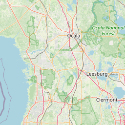
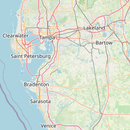
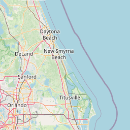

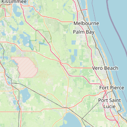


How far is it between Port Orange and Clearwater
Port Orange is located in United States with (29.1383,-80.9956) coordinates and Clearwater is located in United States with (27.9659,-82.8001) coordinates. The calculated flying distance from Port Orange to Clearwater is equal to 136 miles which is equal to 219 km.
If you want to go by car, the driving distance between Port Orange and Clearwater is 262.1 km. If you ride your car with an average speed of 112 kilometers/hour (70 miles/h), travel time will be 02 hours 20 minutes. Please check the avg. speed travel time table on the right for various options.
Difference between fly and go by a car is 43 km.
| City/Place | Latitude and Longitude | GPS Coordinates |
|---|---|---|
| Port Orange | 29.1383, -80.9956 | 29° 8´ 17.9520'' N 80° 59´ 44.1960'' W |
| Clearwater | 27.9659, -82.8001 | 27° 57´ 57.0600'' N 82° 48´ 0.3600'' W |
Estimated Travel Time Between Port Orange and Clearwater
| Average Speed | Travel Time |
|---|---|
| 30 mph (48 km/h) | 05 hours 27 minutes |
| 40 mph (64 km/h) | 04 hours 05 minutes |
| 50 mph (80 km/h) | 03 hours 16 minutes |
| 60 mph (97 km/h) | 02 hours 42 minutes |
| 70 mph (112 km/h) | 02 hours 20 minutes |
| 75 mph (120 km/h) | 02 hours 11 minutes |
Related Distances from Port Orange
| Cities | Distance |
|---|---|
| Port Orange to Daytona Beach | 10 km |
| Port Orange to New Smyrna Beach | 16 km |
| Port Orange to Orlando | 93 km |
| Port Orange to Edgewater | 21 km |
| Port Orange to Jupiter | 285 km |
Related Distances to Clearwater
| Cities | Distance |
|---|---|
| Tampa to Clearwater | 37 km |
| Sarasota to Clearwater | 94 km |
| Orlando to Clearwater | 170 km |
| Naples to Clearwater | 279 km |
| Miami to Clearwater | 460 km |