Distance from Port Orange to Homestead
Distance between Port Orange and Homestead is 411 kilometers (256 miles).
Driving distance from Port Orange to Homestead is 461 kilometers (286 miles).
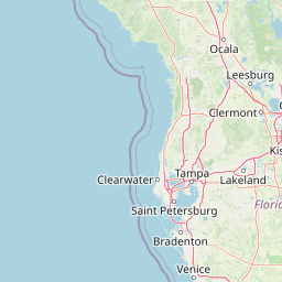
Distance Map Between Port Orange and Homestead
Port Orange, Tallahassee, United States ↔ Homestead, Tallahassee, United States = 256 miles = 411 km.


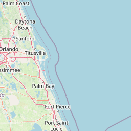
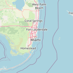


How far is it between Port Orange and Homestead
Port Orange is located in United States with (29.1383,-80.9956) coordinates and Homestead is located in United States with (25.4687,-80.4776) coordinates. The calculated flying distance from Port Orange to Homestead is equal to 256 miles which is equal to 411 km.
If you want to go by car, the driving distance between Port Orange and Homestead is 460.58 km. If you ride your car with an average speed of 112 kilometers/hour (70 miles/h), travel time will be 04 hours 06 minutes. Please check the avg. speed travel time table on the right for various options.
Difference between fly and go by a car is 50 km.
| City/Place | Latitude and Longitude | GPS Coordinates |
|---|---|---|
| Port Orange | 29.1383, -80.9956 | 29° 8´ 17.9520'' N 80° 59´ 44.1960'' W |
| Homestead | 25.4687, -80.4776 | 25° 28´ 7.3920'' N 80° 28´ 39.2160'' W |
Estimated Travel Time Between Port Orange and Homestead
| Average Speed | Travel Time |
|---|---|
| 30 mph (48 km/h) | 09 hours 35 minutes |
| 40 mph (64 km/h) | 07 hours 11 minutes |
| 50 mph (80 km/h) | 05 hours 45 minutes |
| 60 mph (97 km/h) | 04 hours 44 minutes |
| 70 mph (112 km/h) | 04 hours 06 minutes |
| 75 mph (120 km/h) | 03 hours 50 minutes |
Related Distances from Port Orange
| Cities | Distance |
|---|---|
| Port Orange to Daytona Beach | 10 km |
| Port Orange to New Smyrna Beach | 16 km |
| Port Orange to Orlando | 93 km |
| Port Orange to Edgewater | 21 km |
| Port Orange to Jupiter | 285 km |
Related Distances to Homestead
| Cities | Distance |
|---|---|
| West Palm Beach to Homestead | 172 km |
| Orlando to Homestead | 432 km |
| Key West to Homestead | 205 km |
| Tampa to Homestead | 484 km |
| Kendall to Homestead | 39 km |