Distance from Portage to Holland
Distance between Portage and Holland is 78 kilometers (49 miles).
Driving distance from Portage to Holland is 97 kilometers (60 miles).
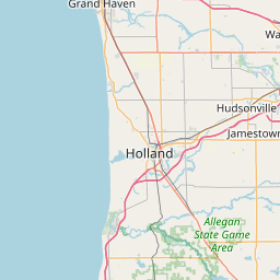
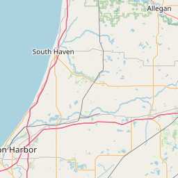
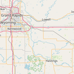
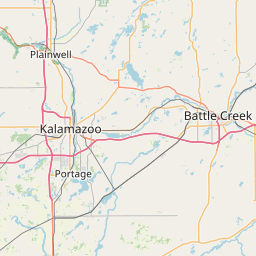
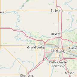
Distance Map Between Portage and Holland
Portage, Lansing, United States ↔ Holland, Lansing, United States = 49 miles = 78 km.


How far is it between Portage and Holland
Portage is located in United States with (42.2012,-85.58) coordinates and Holland is located in United States with (42.7875,-86.1089) coordinates. The calculated flying distance from Portage to Holland is equal to 49 miles which is equal to 78 km.
If you want to go by car, the driving distance between Portage and Holland is 97.12 km. If you ride your car with an average speed of 112 kilometers/hour (70 miles/h), travel time will be 00 hours 52 minutes. Please check the avg. speed travel time table on the right for various options.
Difference between fly and go by a car is 19 km.
| City/Place | Latitude and Longitude | GPS Coordinates |
|---|---|---|
| Portage | 42.2012, -85.58 | 42° 12´ 4.1400'' N 85° 34´ 48.0000'' W |
| Holland | 42.7875, -86.1089 | 42° 47´ 15.0720'' N 86° 6´ 32.1480'' W |
Estimated Travel Time Between Portage and Holland
| Average Speed | Travel Time |
|---|---|
| 30 mph (48 km/h) | 02 hours 01 minutes |
| 40 mph (64 km/h) | 01 hours 31 minutes |
| 50 mph (80 km/h) | 01 hours 12 minutes |
| 60 mph (97 km/h) | 01 hours 00 minutes |
| 70 mph (112 km/h) | 00 hours 52 minutes |
| 75 mph (120 km/h) | 00 hours 48 minutes |
Related Distances from Portage
| Cities | Distance |
|---|---|
| Portage to Adrian | 169 km |
| Portage to Allen Park | 212 km |
| Portage to Allendale | 116 km |
| Portage to Ann Arbor | 162 km |
| Portage to Auburn Hills | 268 km |
| Portage to Battle Creek | 46 km |
| Portage to Bay City | 286 km |
| Portage to Birmingham 3 | 231 km |
| Portage to Burton | 220 km |
| Portage to Canton | 187 km |
Related Distances to Holland
| Cities | Distance |
|---|---|
| Muskegon to Holland | 56 km |
| Holt to Holland | 156 km |
| Walker to Holland | 47 km |
| Portage to Holland | 97 km |
| Livonia to Holland | 268 km |
| Roseville 2 to Holland | 292 km |
| Warren to Holland | 285 km |
| Troy to Holland | 287 km |
| Wyoming to Holland | 40 km |
| Shelby to Holland | 299 km |