Distance from Portage to Markham
Distance between Portage and Markham is 545 kilometers (339 miles).
Driving distance from Portage to Markham is 629 kilometers (391 miles).
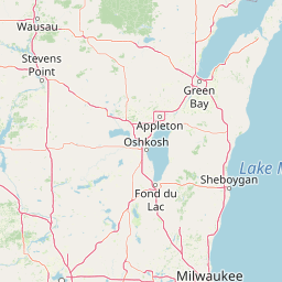
Distance Map Between Portage and Markham
Portage, Lansing, United States ↔ Markham, Ontario, Canada = 339 miles = 545 km.


How far is it between Portage and Markham
Portage is located in United States with (42.2012,-85.58) coordinates and Markham is located in Canada with (43.8668,-79.2663) coordinates. The calculated flying distance from Portage to Markham is equal to 339 miles which is equal to 545 km.
If you want to go by car, the driving distance between Portage and Markham is 629.08 km. If you ride your car with an average speed of 112 kilometers/hour (70 miles/h), travel time will be 05 hours 37 minutes. Please check the avg. speed travel time table on the right for various options.
Difference between fly and go by a car is 84 km.
| City/Place | Latitude and Longitude | GPS Coordinates |
|---|---|---|
| Portage | 42.2012, -85.58 | 42° 12´ 4.1400'' N 85° 34´ 48.0000'' W |
| Markham | 43.8668, -79.2663 | 43° 52´ 0.5520'' N 79° 15´ 58.6800'' W |
Estimated Travel Time Between Portage and Markham
| Average Speed | Travel Time |
|---|---|
| 30 mph (48 km/h) | 13 hours 06 minutes |
| 40 mph (64 km/h) | 09 hours 49 minutes |
| 50 mph (80 km/h) | 07 hours 51 minutes |
| 60 mph (97 km/h) | 06 hours 29 minutes |
| 70 mph (112 km/h) | 05 hours 37 minutes |
| 75 mph (120 km/h) | 05 hours 14 minutes |
Related Distances from Portage
| Cities | Distance |
|---|---|
| Portage to Hamilton | 549 km |
| Portage to Winnipeg | 1634 km |
| Portage to Toronto | 609 km |
| Portage to London 2 | 437 km |
| Portage to Richmond Hill | 618 km |
Related Distances to Markham
| Cities | Distance |
|---|---|
| Ottawa 2 to Markham | 942 km |
| Buffalo to Markham | 197 km |
| Concord 4 to Markham | 921 km |
| Chicago to Markham | 853 km |
| Woodbridge to Markham | 837 km |