Distance from Pucon to Mendoza
Distance between Pucon and Mendoza is 764 kilometers (475 miles).
Driving distance from Pucon to Mendoza is 1145 kilometers (711 miles).
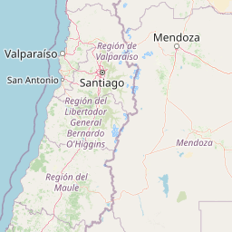
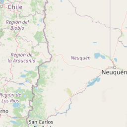
Distance Map Between Pucon and Mendoza
Pucon, Temuco, Chile ↔ Mendoza, Argentina = 475 miles = 764 km.


How far is it between Pucón and Mendoza
Pucon is located in Chile with (-39.2822,-71.9543) coordinates and Mendoza is located in Argentina with (-32.8908,-68.8272) coordinates. The calculated flying distance from Pucon to Mendoza is equal to 475 miles which is equal to 764 km.
If you want to go by car, the driving distance between Pucon and Mendoza is 1144.66 km. If you ride your car with an average speed of 112 kilometers/hour (70 miles/h), travel time will be 10 hours 13 minutes. Please check the avg. speed travel time table on the right for various options.
Difference between fly and go by a car is 381 km.
| City/Place | Latitude and Longitude | GPS Coordinates |
|---|---|---|
| Pucon | -39.2822, -71.9543 | 39° 16´ 56.0280'' S 71° 57´ 15.3720'' W |
| Mendoza | -32.8908, -68.8272 | 32° 53´ 27.0240'' S 68° 49´ 37.8120'' W |
Estimated Travel Time Between Pucón and Mendoza
| Average Speed | Travel Time |
|---|---|
| 30 mph (48 km/h) | 23 hours 50 minutes |
| 40 mph (64 km/h) | 17 hours 53 minutes |
| 50 mph (80 km/h) | 14 hours 18 minutes |
| 60 mph (97 km/h) | 11 hours 48 minutes |
| 70 mph (112 km/h) | 10 hours 13 minutes |
| 75 mph (120 km/h) | 09 hours 32 minutes |
Related Distances from Pucon
| Cities | Distance |
|---|---|
| Pucon to Salta | 2434 km |
| Pucon to Resistencia | 2377 km |
| Pucon to Rosario | 1683 km |
| Pucon to Rio Gallegos | 1950 km |
| Pucon to Santiago Del Estero | 2035 km |
Related Distances to Mendoza
| Cities | Distance |
|---|---|
| Santiago to Mendoza | 363 km |
| Valparaiso to Mendoza | 413 km |
| Vina Del Mar to Mendoza | 405 km |
| Los Andes to Mendoza | 275 km |
| San Antonio 2 to Mendoza | 474 km |