Distance from Puno to Tambopata
Distance between Puno and Tambopata is 360 kilometers (224 miles).
Driving distance from Puno to Tambopata is 573 kilometers (356 miles).
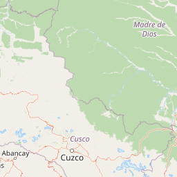
Distance Map Between Puno and Tambopata
Puno, Peru ↔ Tambopata, Puerto Maldonado, Peru = 224 miles = 360 km.


How far is it between Puno and Tambopata
Puno is located in Peru with (-15.8422,-70.0199) coordinates and Tambopata is located in Peru with (-12.6719,-69.3555) coordinates. The calculated flying distance from Puno to Tambopata is equal to 224 miles which is equal to 360 km.
If you want to go by car, the driving distance between Puno and Tambopata is 573.37 km. If you ride your car with an average speed of 112 kilometers/hour (70 miles/h), travel time will be 05 hours 07 minutes. Please check the avg. speed travel time table on the right for various options.
Difference between fly and go by a car is 213 km.
| City/Place | Latitude and Longitude | GPS Coordinates |
|---|---|---|
| Puno | -15.8422, -70.0199 | 15° 50´ 31.9200'' S 70° 1´ 11.6400'' W |
| Tambopata | -12.6719, -69.3555 | 12° 40´ 18.8760'' S 69° 21´ 19.6920'' W |
Estimated Travel Time Between Puno and Tambopata
| Average Speed | Travel Time |
|---|---|
| 30 mph (48 km/h) | 11 hours 56 minutes |
| 40 mph (64 km/h) | 08 hours 57 minutes |
| 50 mph (80 km/h) | 07 hours 10 minutes |
| 60 mph (97 km/h) | 05 hours 54 minutes |
| 70 mph (112 km/h) | 05 hours 07 minutes |
| 75 mph (120 km/h) | 04 hours 46 minutes |
Related Distances from Puno
| Cities | Distance |
|---|---|
| Puno to Trujillo | 1869 km |
| Puno to Tacna | 366 km |
| Puno to Huaraz | 1714 km |
| Puno to Piura | 2297 km |
| Puno to Huanuco | 1689 km |
Related Distances to Tambopata
| Cities | Distance |
|---|---|
| Puerto Maldonado to Tambopata | 24 km |
| Cusco to Tambopata | 444 km |
| Lima to Tambopata | 1538 km |
| Arequipa to Tambopata | 770 km |
| Ica to Tambopata | 1235 km |