Distance from Quevedo to Pereira
Distance between Quevedo and Pereira is 773 kilometers (480 miles).
Driving distance from Quevedo to Pereira is 1162 kilometers (722 miles).
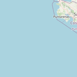
Distance Map Between Quevedo and Pereira
Quevedo, Babahoyo, Ecuador ↔ Pereira, Colombia = 480 miles = 773 km.


How far is it between Quevedo and Pereira
Quevedo is located in Ecuador with (-1.0286,-79.4635) coordinates and Pereira is located in Colombia with (4.8133,-75.6961) coordinates. The calculated flying distance from Quevedo to Pereira is equal to 480 miles which is equal to 773 km.
If you want to go by car, the driving distance between Quevedo and Pereira is 1162.17 km. If you ride your car with an average speed of 112 kilometers/hour (70 miles/h), travel time will be 10 hours 22 minutes. Please check the avg. speed travel time table on the right for various options.
Difference between fly and go by a car is 389 km.
| City/Place | Latitude and Longitude | GPS Coordinates |
|---|---|---|
| Quevedo | -1.0286, -79.4635 | 1° 1´ 43.0680'' S 79° 27´ 48.6720'' W |
| Pereira | 4.8133, -75.6961 | 4° 48´ 47.9880'' N 75° 41´ 45.9960'' W |
Estimated Travel Time Between Quevedo and Pereira
| Average Speed | Travel Time |
|---|---|
| 30 mph (48 km/h) | 24 hours 12 minutes |
| 40 mph (64 km/h) | 18 hours 09 minutes |
| 50 mph (80 km/h) | 14 hours 31 minutes |
| 60 mph (97 km/h) | 11 hours 58 minutes |
| 70 mph (112 km/h) | 10 hours 22 minutes |
| 75 mph (120 km/h) | 09 hours 41 minutes |
Related Distances from Quevedo
| Cities | Distance |
|---|---|
| Quevedo to Medellin | 1392 km |
| Quevedo to Cali | 961 km |
| Quevedo to Bogota | 1310 km |
| Quevedo to Cucuta | 1896 km |
| Quevedo to Barranquilla | 2188 km |
Related Distances to Pereira
| Cities | Distance |
|---|---|
| Quito to Pereira | 925 km |
| Guayaquil to Pereira | 1318 km |
| La Libertad to Pereira | 1471 km |
| La Mana to Pereira | 1148 km |
| Chone to Pereira | 1214 km |