Distance from Ramos to Subic
Distance between Ramos and Subic is 98 kilometers (61 miles).
Driving distance from Ramos to Subic is 138 kilometers (86 miles).
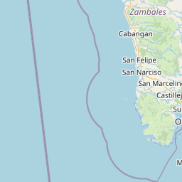
Distance Map Between Ramos and Subic
Ramos, , Philippines ↔ Subic, , Philippines = 61 miles = 98 km.

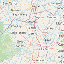
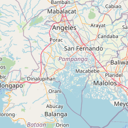


How far is it between Ramos and Subic
Ramos is located in Philippines with (15.6653,120.6406) coordinates and Subic is located in Philippines with (14.88,120.2343) coordinates. The calculated flying distance from Ramos to Subic is equal to 61 miles which is equal to 98 km.
If you want to go by car, the driving distance between Ramos and Subic is 138 km. If you ride your car with an average speed of 112 kilometers/hour (70 miles/h), travel time will be 01 hours 13 minutes. Please check the avg. speed travel time table on the right for various options.
Difference between fly and go by a car is 40 km.
| City/Place | Latitude and Longitude | GPS Coordinates |
|---|---|---|
| Ramos | 15.6653, 120.6406 | 15° 39´ 55.0800'' N 120° 38´ 26.1600'' E |
| Subic | 14.88, 120.2343 | 14° 52´ 47.9640'' N 120° 14´ 3.5880'' E |
Estimated Travel Time Between Ramos and Subic
| Average Speed | Travel Time |
|---|---|
| 30 mph (48 km/h) | 02 hours 52 minutes |
| 40 mph (64 km/h) | 02 hours 09 minutes |
| 50 mph (80 km/h) | 01 hours 43 minutes |
| 60 mph (97 km/h) | 01 hours 25 minutes |
| 70 mph (112 km/h) | 01 hours 13 minutes |
| 75 mph (120 km/h) | 01 hours 09 minutes |
Related Distances from Ramos
| Cities | Distance |
|---|---|
| Ramos to Tarlac City | 27 km |
| Ramos to Subic | 138 km |
| Ramos to San Simon | 97 km |
| Ramos to Santa Ana 3 | 77 km |
| Ramos to San Fernando | 86 km |
Related Distances to Subic
| Cities | Distance |
|---|---|
| Bulacan to Subic | 107 km |
| Olongapo to Subic | 12 km |
| Tarlac City to Subic | 124 km |
| San Fernando to Subic | 69 km |
| Angeles City to Subic | 83 km |