Distance from Randwick to Forster
Distance between Randwick and Forster is 226 kilometers (140 miles).
Driving distance from Randwick to Forster is 313 kilometers (194 miles).
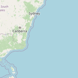
Distance Map Between Randwick and Forster
Randwick, Sydney, Australia ↔ Forster, Sydney, Australia = 140 miles = 226 km.

How far is it between Randwick and Forster
Randwick is located in Australia with (-33.9144,151.249) coordinates and Forster is located in Australia with (-32.1814,152.5172) coordinates. The calculated flying distance from Randwick to Forster is equal to 140 miles which is equal to 226 km.
If you want to go by car, the driving distance between Randwick and Forster is 312.87 km. If you ride your car with an average speed of 112 kilometers/hour (70 miles/h), travel time will be 02 hours 47 minutes. Please check the avg. speed travel time table on the right for various options.
Difference between fly and go by a car is 87 km.
| City/Place | Latitude and Longitude | GPS Coordinates |
|---|---|---|
| Randwick | -33.9144, 151.249 | 33° 54´ 51.8040'' S 151° 14´ 56.2200'' E |
| Forster | -32.1814, 152.5172 | 32° 10´ 52.8960'' S 152° 31´ 1.7400'' E |
Estimated Travel Time Between Randwick and Forster
| Average Speed | Travel Time |
|---|---|
| 30 mph (48 km/h) | 06 hours 31 minutes |
| 40 mph (64 km/h) | 04 hours 53 minutes |
| 50 mph (80 km/h) | 03 hours 54 minutes |
| 60 mph (97 km/h) | 03 hours 13 minutes |
| 70 mph (112 km/h) | 02 hours 47 minutes |
| 75 mph (120 km/h) | 02 hours 36 minutes |
Related Distances from Randwick
| Cities | Distance |
|---|---|
| Randwick to Liverpool 2 | 40 km |
| Randwick to Maroubra | 6 km |
| Randwick to Nowra | 160 km |
| Randwick to Wollongong | 83 km |
| Randwick to Marrickville | 12 km |
Related Distances to Forster
| Cities | Distance |
|---|---|
| Coffs Harbour to Forster | 255 km |
| Dubbo to Forster | 516 km |
| Armidale to Forster | 284 km |
| Wollongong to Forster | 411 km |
| Broken Hill to Forster | 1269 km |