Distance from Rewari to Sirsa
Distance between Rewari and Sirsa is 215 kilometers (133 miles).
Driving distance from Rewari to Sirsa is 273 kilometers (169 miles).
Distance Map Between Rewari and Sirsa
Rewari, , India ↔ Sirsa, , India = 133 miles = 215 km.


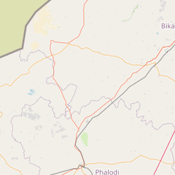


Leaflet | © OpenStreetMap
How far is it between Rewāri and Sirsa
Rewari is located in India with (28.1972,76.6176) coordinates and Sirsa is located in India with (29.5349,75.029) coordinates. The calculated flying distance from Rewari to Sirsa is equal to 133 miles which is equal to 215 km.
If you want to go by car, the driving distance between Rewari and Sirsa is 272.7 km. If you ride your car with an average speed of 112 kilometers/hour (70 miles/h), travel time will be 02 hours 26 minutes. Please check the avg. speed travel time table on the right for various options.
Difference between fly and go by a car is 58 km.
| City/Place | Latitude and Longitude | GPS Coordinates |
|---|---|---|
| Rewari | 28.1972, 76.6176 | 28° 11´ 49.9560'' N 76° 37´ 3.2520'' E |
| Sirsa | 29.5349, 75.029 | 29° 32´ 5.6040'' N 75° 1´ 44.3280'' E |
Estimated Travel Time Between Rewāri and Sirsa
| Average Speed | Travel Time |
|---|---|
| 30 mph (48 km/h) | 05 hours 40 minutes |
| 40 mph (64 km/h) | 04 hours 15 minutes |
| 50 mph (80 km/h) | 03 hours 24 minutes |
| 60 mph (97 km/h) | 02 hours 48 minutes |
| 70 mph (112 km/h) | 02 hours 26 minutes |
| 75 mph (120 km/h) | 02 hours 16 minutes |
Rewari, , India
Related Distances from Rewari
| Cities | Distance |
|---|---|
| Rewari to Sohna | 60 km |
| Rewari to Rohtak | 85 km |
| Rewari to Samalkha | 141 km |
| Rewari to Safidon | 168 km |
| Rewari to Yamunanagar | 273 km |
Sirsa, , India
Related Distances to Sirsa
| Cities | Distance |
|---|---|
| Agra to Sirsaganj | 77 km |
| Rania to Sirsa | 22 km |
| Firozabad to Sirsaganj | 32 km |
| Ellenabad to Sirsa | 44 km |
| Etawah to Sirsaganj | 48 km |