Distance from Rolling Meadows to London
Distance between Rolling Meadows and London is 564 kilometers (351 miles).
Driving distance from Rolling Meadows to London is 715 kilometers (444 miles).
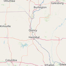
Distance Map Between Rolling Meadows and London
Rolling Meadows, Springfield, United States ↔ London, Ontario, Canada = 351 miles = 564 km.


How far is it between Rolling Meadows and London
Rolling Meadows is located in United States with (42.0842,-88.0131) coordinates and London is located in Canada with (42.9834,-81.233) coordinates. The calculated flying distance from Rolling Meadows to London is equal to 351 miles which is equal to 564 km.
If you want to go by car, the driving distance between Rolling Meadows and London is 714.76 km. If you ride your car with an average speed of 112 kilometers/hour (70 miles/h), travel time will be 06 hours 22 minutes. Please check the avg. speed travel time table on the right for various options.
Difference between fly and go by a car is 151 km.
| City/Place | Latitude and Longitude | GPS Coordinates |
|---|---|---|
| Rolling Meadows | 42.0842, -88.0131 | 42° 5´ 3.0840'' N 88° 0´ 47.2680'' W |
| London | 42.9834, -81.233 | 42° 59´ 0.2040'' N 81° 13´ 58.9440'' W |
Estimated Travel Time Between Rolling Meadows and London
| Average Speed | Travel Time |
|---|---|
| 30 mph (48 km/h) | 14 hours 53 minutes |
| 40 mph (64 km/h) | 11 hours 10 minutes |
| 50 mph (80 km/h) | 08 hours 56 minutes |
| 60 mph (97 km/h) | 07 hours 22 minutes |
| 70 mph (112 km/h) | 06 hours 22 minutes |
| 75 mph (120 km/h) | 05 hours 57 minutes |
Related Distances from Rolling Meadows
| Cities | Distance |
|---|---|
| Rolling Meadows to Etobicoke | 872 km |
| Rolling Meadows to Ottawa | 1324 km |
| Rolling Meadows to Toronto | 887 km |
| Rolling Meadows to Montreal | 1419 km |
| Rolling Meadows to London 2 | 715 km |
Related Distances to London
| Cities | Distance |
|---|---|
| New York City to London 2 | 861 km |
| Kent 2 to London 2 | 501 km |
| Boston to London 2 | 954 km |
| Suffolk to London 2 | 1137 km |
| Jamaica to London 2 | 890 km |