Distance from Rome to Ivatsevichy
Distance between Rome and Ivatsevichy is 1539 kilometers (956 miles).
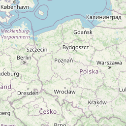
Distance Map Between Rome and Ivatsevichy
Rome, Italy ↔ Ivatsevichy, Brest, Belarus = 956 miles = 1539 km.


Leaflet | © OpenStreetMap
How far is it between Rome and Ivatsevichy
Rome is located in Italy with (41.8919,12.5113) coordinates and Ivatsevichy is located in Belarus with (52.709,25.3401) coordinates. The calculated flying distance from Rome to Ivatsevichy is equal to 956 miles which is equal to 1539 km.
| City/Place | Latitude and Longitude | GPS Coordinates |
|---|---|---|
| Rome | 41.8919, 12.5113 | 41° 53´ 30.9480'' N 12° 30´ 40.7880'' E |
| Ivatsevichy | 52.709, 25.3401 | 52° 42´ 32.4000'' N 25° 20´ 24.3600'' E |
Rome, Italy
Related Distances from Rome
| Cities | Distance |
|---|---|
| Rome to Minsk | 2340 km |
| Rome to Masty | 2104 km |
| Rome to Vitebsk | 2613 km |
| Rome to Dobrush | 2563 km |
| Rome to Shchuchin | 2123 km |
| Rome to Orsha | 2542 km |
| Rome to Hrodna | 2063 km |
| Rome to Navahrudak | 2208 km |
| Rome to Rahachow | 2528 km |
| Rome to Slutsk | 2295 km |
Ivatsevichy, Brest, Belarus
Related Distances to Ivatsevichy
| Cities | Distance |
|---|---|
| Milano to Ivatsevichy | 1869 km |