Distance from Ronse to Tienen
Distance between Ronse and Tienen is 94 kilometers (59 miles).
Driving distance from Ronse to Tienen is 140 kilometers (87 miles).
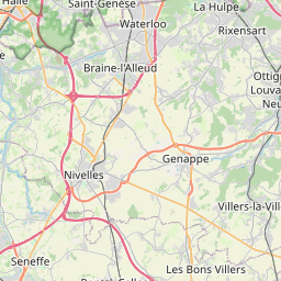
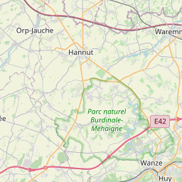
Distance Map Between Ronse and Tienen
Ronse, , Belgium ↔ Tienen, , Belgium = 59 miles = 94 km.


How far is it between Ronse and Tienen
Ronse is located in Belgium with (50.7457,3.6005) coordinates and Tienen is located in Belgium with (50.8075,4.9378) coordinates. The calculated flying distance from Ronse to Tienen is equal to 59 miles which is equal to 94 km.
If you want to go by car, the driving distance between Ronse and Tienen is 139.84 km. If you ride your car with an average speed of 112 kilometers/hour (70 miles/h), travel time will be 01 hours 14 minutes. Please check the avg. speed travel time table on the right for various options.
Difference between fly and go by a car is 46 km.
| City/Place | Latitude and Longitude | GPS Coordinates |
|---|---|---|
| Ronse | 50.7457, 3.6005 | 50° 44´ 44.6640'' N 3° 36´ 1.8000'' E |
| Tienen | 50.8075, 4.9378 | 50° 48´ 26.8200'' N 4° 56´ 16.0800'' E |
Estimated Travel Time Between Ronse and Tienen
| Average Speed | Travel Time |
|---|---|
| 30 mph (48 km/h) | 02 hours 54 minutes |
| 40 mph (64 km/h) | 02 hours 11 minutes |
| 50 mph (80 km/h) | 01 hours 44 minutes |
| 60 mph (97 km/h) | 01 hours 26 minutes |
| 70 mph (112 km/h) | 01 hours 14 minutes |
| 75 mph (120 km/h) | 01 hours 09 minutes |
Related Distances from Ronse
| Cities | Distance |
|---|---|
| Ronse to Waregem | 24 km |
| Ronse to Zwijndrecht 2 | 86 km |
| Ronse to Zele | 62 km |
| Ronse to Rotselaar | 128 km |
| Ronse to Zottegem | 27 km |
Related Distances to Tienen
| Cities | Distance |
|---|---|
| Leuven to Tienen | 20 km |
| Essen 2 to Tienen | 121 km |
| Roeselare to Tienen | 169 km |
| Houthalen to Tienen | 49 km |
| Mol to Tienen | 63 km |