Distance from Roselle to Quincy
Distance between Roselle and Quincy is 361 kilometers (224 miles).
Driving distance from Roselle to Quincy is 499 kilometers (310 miles).
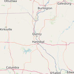
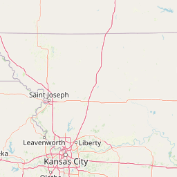
Distance Map Between Roselle and Quincy
Roselle, Springfield, United States ↔ Quincy, Springfield, United States = 224 miles = 361 km.


How far is it between Roselle and Quincy
Roselle is located in United States with (41.9848,-88.0798) coordinates and Quincy is located in United States with (39.9356,-91.4099) coordinates. The calculated flying distance from Roselle to Quincy is equal to 224 miles which is equal to 361 km.
If you want to go by car, the driving distance between Roselle and Quincy is 499.14 km. If you ride your car with an average speed of 112 kilometers/hour (70 miles/h), travel time will be 04 hours 27 minutes. Please check the avg. speed travel time table on the right for various options.
Difference between fly and go by a car is 138 km.
| City/Place | Latitude and Longitude | GPS Coordinates |
|---|---|---|
| Roselle | 41.9848, -88.0798 | 41° 59´ 5.1000'' N 88° 4´ 47.2440'' W |
| Quincy | 39.9356, -91.4099 | 39° 56´ 8.1600'' N 91° 24´ 35.5320'' W |
Estimated Travel Time Between Roselle and Quincy
| Average Speed | Travel Time |
|---|---|
| 30 mph (48 km/h) | 10 hours 23 minutes |
| 40 mph (64 km/h) | 07 hours 47 minutes |
| 50 mph (80 km/h) | 06 hours 14 minutes |
| 60 mph (97 km/h) | 05 hours 08 minutes |
| 70 mph (112 km/h) | 04 hours 27 minutes |
| 75 mph (120 km/h) | 04 hours 09 minutes |
Related Distances from Roselle
| Cities | Distance |
|---|---|
| Roselle to Carol Stream | 13 km |
| Roselle to Downers Grove | 29 km |
| Roselle to Bartlett 2 | 11 km |
| Roselle to Glen Ellyn | 13 km |
| Roselle to Chicago | 49 km |
Related Distances to Quincy
| Cities | Distance |
|---|---|
| Chicago to Quincy 2 | 498 km |
| Peoria 2 to Quincy 2 | 205 km |
| Lansing 2 to Quincy 2 | 490 km |
| Northbrook to Quincy 2 | 518 km |
| Champaign to Quincy 2 | 315 km |