Distance from Rostov to Lodz
Distance between Rostov and Lodz is 1417 kilometers (880 miles).
Driving distance from Rostov to Lodz is 1598 kilometers (993 miles).
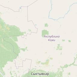
Distance Map Between Rostov and Lodz
Rostov, Yaroslavl, Russia ↔ Lodz, Poland = 880 miles = 1417 km.


How far is it between Rostov and Łódź
Rostov is located in Russia with (57.1914,39.4139) coordinates and Lodz is located in Poland with (51.75,19.4667) coordinates. The calculated flying distance from Rostov to Lodz is equal to 880 miles which is equal to 1417 km.
If you want to go by car, the driving distance between Rostov and Lodz is 1598.01 km. If you ride your car with an average speed of 112 kilometers/hour (70 miles/h), travel time will be 14 hours 16 minutes. Please check the avg. speed travel time table on the right for various options.
Difference between fly and go by a car is 181 km.
| City/Place | Latitude and Longitude | GPS Coordinates |
|---|---|---|
| Rostov | 57.1914, 39.4139 | 57° 11´ 29.0400'' N 39° 24´ 50.1840'' E |
| Lodz | 51.75, 19.4667 | 51° 45´ 0.0000'' N 19° 28´ 0.0120'' E |
Estimated Travel Time Between Rostov and Łódź
| Average Speed | Travel Time |
|---|---|
| 30 mph (48 km/h) | 33 hours 17 minutes |
| 40 mph (64 km/h) | 24 hours 58 minutes |
| 50 mph (80 km/h) | 19 hours 58 minutes |
| 60 mph (97 km/h) | 16 hours 28 minutes |
| 70 mph (112 km/h) | 14 hours 16 minutes |
| 75 mph (120 km/h) | 13 hours 19 minutes |
Related Distances from Rostov
| Cities | Distance |
|---|---|
| Rostov to Lodz | 1598 km |
| Rostov to Krakow | 1735 km |
| Rostov to Warsaw | 1472 km |
Related Distances to Lodz
| Cities | Distance |
|---|---|
| Moscow to Lodz | 1379 km |
| Saint Petersburg to Lodz | 1303 km |
| Rostov to Lodz | 1598 km |
| Venev to Lodz | 1540 km |
| Pokrov to Lodz | 1500 km |