Distance from Roth to Schrobenhausen
Distance between Roth and Schrobenhausen is 77 kilometers (48 miles).
Driving distance from Roth to Schrobenhausen is 111 kilometers (69 miles).
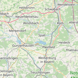
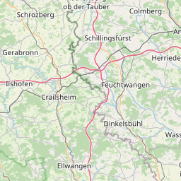
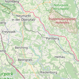
Distance Map Between Roth and Schrobenhausen
Roth, Munich, Germany ↔ Schrobenhausen, Munich, Germany = 48 miles = 77 km.


How far is it between Roth and Schrobenhausen
Roth is located in Germany with (49.2476,11.0911) coordinates and Schrobenhausen is located in Germany with (48.5607,11.2607) coordinates. The calculated flying distance from Roth to Schrobenhausen is equal to 48 miles which is equal to 77 km.
If you want to go by car, the driving distance between Roth and Schrobenhausen is 110.99 km. If you ride your car with an average speed of 112 kilometers/hour (70 miles/h), travel time will be 00 hours 59 minutes. Please check the avg. speed travel time table on the right for various options.
Difference between fly and go by a car is 34 km.
| City/Place | Latitude and Longitude | GPS Coordinates |
|---|---|---|
| Roth | 49.2476, 11.0911 | 49° 14´ 51.4320'' N 11° 5´ 27.9960'' E |
| Schrobenhausen | 48.5607, 11.2607 | 48° 33´ 38.4120'' N 11° 15´ 38.5560'' E |
Estimated Travel Time Between Roth and Schrobenhausen
| Average Speed | Travel Time |
|---|---|
| 30 mph (48 km/h) | 02 hours 18 minutes |
| 40 mph (64 km/h) | 01 hours 44 minutes |
| 50 mph (80 km/h) | 01 hours 23 minutes |
| 60 mph (97 km/h) | 01 hours 08 minutes |
| 70 mph (112 km/h) | 00 hours 59 minutes |
| 75 mph (120 km/h) | 00 hours 55 minutes |
Related Distances from Roth
| Cities | Distance |
|---|---|
| Roth to Schrobenhausen | 111 km |
| Roth to Schwabach | 17 km |
| Roth to Schwandorf In Bayern | 101 km |
| Roth to Schweinfurt | 153 km |
| Roth to Selb | 192 km |
| Roth to Sonthofen | 295 km |
| Roth to Starnberg | 177 km |
| Roth to Straubing | 160 km |
| Roth to Sulzbach Rosenberg | 73 km |
| Roth to Taufkirchen | 171 km |