Distance from Salem to Randolph
Distance between Salem and Randolph is 41 kilometers (26 miles).
Driving distance from Salem to Randolph is 62 kilometers (38 miles).
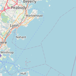
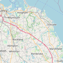
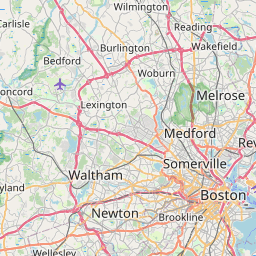
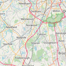
Distance Map Between Salem and Randolph
Salem, Boston, United States ↔ Randolph, Boston, United States = 26 miles = 41 km.

How far is it between Salem and Randolph
Salem is located in United States with (42.5195,-70.8967) coordinates and Randolph is located in United States with (42.1626,-71.0412) coordinates. The calculated flying distance from Salem to Randolph is equal to 26 miles which is equal to 41 km.
If you want to go by car, the driving distance between Salem and Randolph is 61.7 km. If you ride your car with an average speed of 112 kilometers/hour (70 miles/h), travel time will be 00 hours 33 minutes. Please check the avg. speed travel time table on the right for various options.
Difference between fly and go by a car is 21 km.
| City/Place | Latitude and Longitude | GPS Coordinates |
|---|---|---|
| Salem | 42.5195, -70.8967 | 42° 31´ 10.3440'' N 70° 53´ 48.1920'' W |
| Randolph | 42.1626, -71.0412 | 42° 9´ 45.3600'' N 71° 2´ 28.1760'' W |
Estimated Travel Time Between Salem and Randolph
| Average Speed | Travel Time |
|---|---|
| 30 mph (48 km/h) | 01 hours 17 minutes |
| 40 mph (64 km/h) | 00 hours 57 minutes |
| 50 mph (80 km/h) | 00 hours 46 minutes |
| 60 mph (97 km/h) | 00 hours 38 minutes |
| 70 mph (112 km/h) | 00 hours 33 minutes |
| 75 mph (120 km/h) | 00 hours 30 minutes |
Related Distances from Salem
| Cities | Distance |
|---|---|
| Salem 3 to Medford 2 | 34 km |
| Salem 3 to Cambridge 3 | 40 km |
| Salem 3 to Burlington 5 | 31 km |
| Salem 3 to Gloucester 2 | 27 km |
| Salem 3 to Marblehead | 6 km |
Related Distances to Randolph
| Cities | Distance |
|---|---|
| Stoughton to Randolph | 8 km |
| Rockland to Randolph | 12 km |
| Somerville to Randolph | 33 km |
| Weymouth to Randolph | 15 km |
| Salem 3 to Randolph | 62 km |