Distance from San Antonio to Tepic
Distance between San Antonio and Tepic is 1089 kilometers (677 miles).
Driving distance from San Antonio to Tepic is 1517 kilometers (943 miles).
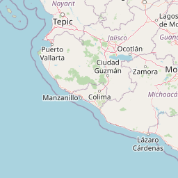
Distance Map Between San Antonio and Tepic
San Antonio, Austin, United States ↔ Tepic, Mexico = 677 miles = 1089 km.


How far is it between San Antonio and Tepic
San Antonio is located in United States with (29.4241,-98.4936) coordinates and Tepic is located in Mexico with (21.5095,-104.8957) coordinates. The calculated flying distance from San Antonio to Tepic is equal to 677 miles which is equal to 1089 km.
If you want to go by car, the driving distance between San Antonio and Tepic is 1517.05 km. If you ride your car with an average speed of 112 kilometers/hour (70 miles/h), travel time will be 13 hours 32 minutes. Please check the avg. speed travel time table on the right for various options.
Difference between fly and go by a car is 428 km.
| City/Place | Latitude and Longitude | GPS Coordinates |
|---|---|---|
| San Antonio | 29.4241, -98.4936 | 29° 25´ 26.8320'' N 98° 29´ 37.0680'' W |
| Tepic | 21.5095, -104.8957 | 21° 30´ 34.2360'' N 104° 53´ 44.4840'' W |
Estimated Travel Time Between San Antonio and Tepic
| Average Speed | Travel Time |
|---|---|
| 30 mph (48 km/h) | 31 hours 36 minutes |
| 40 mph (64 km/h) | 23 hours 42 minutes |
| 50 mph (80 km/h) | 18 hours 57 minutes |
| 60 mph (97 km/h) | 15 hours 38 minutes |
| 70 mph (112 km/h) | 13 hours 32 minutes |
| 75 mph (120 km/h) | 12 hours 38 minutes |
Related Distances from San Antonio
| Cities | Distance |
|---|---|
| San Antonio to Abasolo | 1208 km |
| San Antonio to Acajete | 1519 km |
| San Antonio to Acambaro | 1271 km |
| San Antonio to Acaponeta | 1400 km |
| San Antonio to Acapulco De Juarez | 1756 km |
| San Antonio to Acatlan De Osorio | 1642 km |
| San Antonio to Acatzingo De Hidalgo | 1537 km |
| San Antonio to Acayucan | 1639 km |
| San Antonio to Actopan | 1365 km |
| San Antonio to Agua Dulce | 1737 km |
Related Distances to Tepic
| Cities | Distance |
|---|---|
| Dallas to Tepic | 1954 km |
| Houston to Tepic | 1826 km |
| Phoenix to Tepic | 1715 km |
| Nashville to Tepic | 3022 km |
| Los Angeles to Tepic | 2313 km |
| Austin to Tepic | 1641 km |
| El Paso to Tepic | 1522 km |
| Fort Worth to Tepic | 1940 km |
| San Antonio to Tepic | 1517 km |
| Memphis to Tepic | 2682 km |