Distance from San Diego to La Quinta
Distance between San Diego and La Quinta is 132 kilometers (82 miles).
Driving distance from San Diego to La Quinta is 209 kilometers (130 miles).
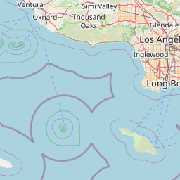
Distance Map Between San Diego and La Quinta
San Diego, Sacramento, United States ↔ La Quinta, Sacramento, United States = 82 miles = 132 km.

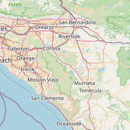
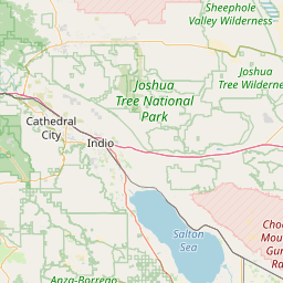
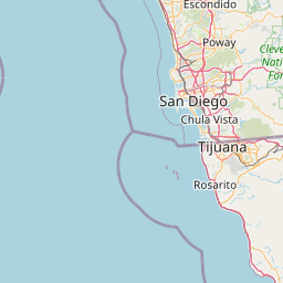
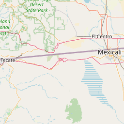


How far is it between San Diego and La Quinta
San Diego is located in United States with (32.7153,-117.1573) coordinates and La Quinta is located in United States with (33.6634,-116.31) coordinates. The calculated flying distance from San Diego to La Quinta is equal to 82 miles which is equal to 132 km.
If you want to go by car, the driving distance between San Diego and La Quinta is 208.76 km. If you ride your car with an average speed of 112 kilometers/hour (70 miles/h), travel time will be 01 hours 51 minutes. Please check the avg. speed travel time table on the right for various options.
Difference between fly and go by a car is 77 km.
| City/Place | Latitude and Longitude | GPS Coordinates |
|---|---|---|
| San Diego | 32.7153, -117.1573 | 32° 42´ 55.1880'' N 117° 9´ 26.1360'' W |
| La Quinta | 33.6634, -116.31 | 33° 39´ 48.0960'' N 116° 18´ 36.0360'' W |
Estimated Travel Time Between San Diego and La Quinta
| Average Speed | Travel Time |
|---|---|
| 30 mph (48 km/h) | 04 hours 20 minutes |
| 40 mph (64 km/h) | 03 hours 15 minutes |
| 50 mph (80 km/h) | 02 hours 36 minutes |
| 60 mph (97 km/h) | 02 hours 09 minutes |
| 70 mph (112 km/h) | 01 hours 51 minutes |
| 75 mph (120 km/h) | 01 hours 44 minutes |
Related Distances from San Diego
| Cities | Distance |
|---|---|
| San Diego to Los Angeles | 195 km |
| San Diego to Palm Springs | 224 km |
| San Diego to La Jolla | 22 km |
| San Diego to Carlsbad | 56 km |
| San Diego to Riverside | 164 km |
Related Distances to La Quinta
| Cities | Distance |
|---|---|
| Los Angeles to La Quinta | 207 km |
| San Diego to La Quinta | 209 km |
| Temecula to La Quinta | 118 km |
| Riverside to La Quinta | 126 km |
| Pasadena 2 to La Quinta | 205 km |