Distance from Santiago to Sapucaia
Distance between Santiago and Sapucaia is 1886 kilometers (1172 miles).
Driving distance from Santiago to Sapucaia is 2375 kilometers (1476 miles).
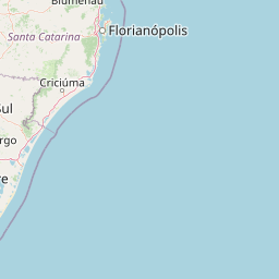
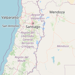
Distance Map Between Santiago and Sapucaia
Santiago, Chile ↔ Sapucaia, Porto Alegre, Brazil = 1172 miles = 1886 km.


How far is it between Santiago and Sapucaia
Santiago is located in Chile with (-33.4569,-70.6483) coordinates and Sapucaia is located in Brazil with (-29.8333,-51.15) coordinates. The calculated flying distance from Santiago to Sapucaia is equal to 1172 miles which is equal to 1886 km.
If you want to go by car, the driving distance between Santiago and Sapucaia is 2375.15 km. If you ride your car with an average speed of 112 kilometers/hour (70 miles/h), travel time will be 21 hours 12 minutes. Please check the avg. speed travel time table on the right for various options.
Difference between fly and go by a car is 489 km.
| City/Place | Latitude and Longitude | GPS Coordinates |
|---|---|---|
| Santiago | -33.4569, -70.6483 | 33° 27´ 24.9840'' S 70° 38´ 53.7720'' W |
| Sapucaia | -29.8333, -51.15 | 29° 49´ 59.9880'' S 51° 8´ 60.0000'' W |
Estimated Travel Time Between Santiago and Sapucaia
| Average Speed | Travel Time |
|---|---|
| 30 mph (48 km/h) | 49 hours 28 minutes |
| 40 mph (64 km/h) | 37 hours 06 minutes |
| 50 mph (80 km/h) | 29 hours 41 minutes |
| 60 mph (97 km/h) | 24 hours 29 minutes |
| 70 mph (112 km/h) | 21 hours 12 minutes |
| 75 mph (120 km/h) | 19 hours 47 minutes |
Related Distances from Santiago
| Cities | Distance |
|---|---|
| Santiago to Ijui | 2127 km |
| Santiago to Porto Alegre | 2360 km |
| Santiago to Toledo 3 | 2495 km |
| Santiago to Colorado | 2829 km |
| Santiago to Campo Grande | 3059 km |
Related Distances to Sapucaia
| Cities | Distance |
|---|---|
| Santiago to Sapucaia | 2375 km |
| Puente Alto to Sapucaia | 2398 km |