Distance from Satka to Zlatoust
Distance between Satka and Zlatoust is 41 kilometers (26 miles).
Driving distance from Satka to Zlatoust is 49 kilometers (31 miles).
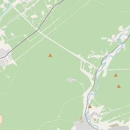
Distance Map Between Satka and Zlatoust
Satka, Chelyabinsk, Russia ↔ Zlatoust, Chelyabinsk, Russia = 26 miles = 41 km.


How far is it between Satka and Zlatoust
Satka is located in Russia with (55.0425,59.04) coordinates and Zlatoust is located in Russia with (55.1711,59.6508) coordinates. The calculated flying distance from Satka to Zlatoust is equal to 26 miles which is equal to 41 km.
If you want to go by car, the driving distance between Satka and Zlatoust is 49.18 km. If you ride your car with an average speed of 112 kilometers/hour (70 miles/h), travel time will be 00 hours 26 minutes. Please check the avg. speed travel time table on the right for various options.
Difference between fly and go by a car is 8 km.
| City/Place | Latitude and Longitude | GPS Coordinates |
|---|---|---|
| Satka | 55.0425, 59.04 | 55° 2´ 33.0000'' N 59° 2´ 24.0000'' E |
| Zlatoust | 55.1711, 59.6508 | 55° 10´ 15.9960'' N 59° 39´ 2.9880'' E |
Estimated Travel Time Between Satka and Zlatoust
| Average Speed | Travel Time |
|---|---|
| 30 mph (48 km/h) | 01 hours 01 minutes |
| 40 mph (64 km/h) | 00 hours 46 minutes |
| 50 mph (80 km/h) | 00 hours 36 minutes |
| 60 mph (97 km/h) | 00 hours 30 minutes |
| 70 mph (112 km/h) | 00 hours 26 minutes |
| 75 mph (120 km/h) | 00 hours 24 minutes |
Related Distances from Satka
| Cities | Distance |
|---|---|
| Satka to Sim | 114 km |
| Satka to Zlatoust | 49 km |
| Satka to Ust Katav | 84 km |
| Satka to Magnitogorsk | 313 km |
Related Distances to Zlatoust
| Cities | Distance |
|---|---|
| Kasli to Zlatoust | 149 km |
| Snezhinsk to Zlatoust | 171 km |
| Bakal to Zlatoust | 71 km |
| Korkino to Zlatoust | 154 km |
| Chebarkul to Zlatoust | 75 km |