Distance from Seal Beach to Tijuana
Distance between Seal Beach and Tijuana is 172 kilometers (107 miles).
Driving distance from Seal Beach to Tijuana is 195 kilometers (121 miles).
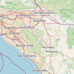
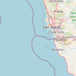
Distance Map Between Seal Beach and Tijuana
Seal Beach, Sacramento, United States ↔ Tijuana, Mexicali, Mexico = 107 miles = 172 km.


How far is it between Seal Beach and Tijuana
Seal Beach is located in United States with (33.7414,-118.1048) coordinates and Tijuana is located in Mexico with (32.5027,-117.0037) coordinates. The calculated flying distance from Seal Beach to Tijuana is equal to 107 miles which is equal to 172 km.
If you want to go by car, the driving distance between Seal Beach and Tijuana is 194.57 km. If you ride your car with an average speed of 112 kilometers/hour (70 miles/h), travel time will be 01 hours 44 minutes. Please check the avg. speed travel time table on the right for various options.
Difference between fly and go by a car is 23 km.
| City/Place | Latitude and Longitude | GPS Coordinates |
|---|---|---|
| Seal Beach | 33.7414, -118.1048 | 33° 44´ 29.0760'' N 118° 6´ 17.2440'' W |
| Tijuana | 32.5027, -117.0037 | 32° 30´ 9.7200'' N 117° 0´ 13.3560'' W |
Estimated Travel Time Between Seal Beach and Tijuana
| Average Speed | Travel Time |
|---|---|
| 30 mph (48 km/h) | 04 hours 03 minutes |
| 40 mph (64 km/h) | 03 hours 02 minutes |
| 50 mph (80 km/h) | 02 hours 25 minutes |
| 60 mph (97 km/h) | 02 hours 00 minutes |
| 70 mph (112 km/h) | 01 hours 44 minutes |
| 75 mph (120 km/h) | 01 hours 37 minutes |
Related Distances from Seal Beach
| Cities | Distance |
|---|---|
| Seal Beach to San Luis Potosi | 2683 km |
| Seal Beach to Mexico City | 3121 km |
| Seal Beach to Ciudad Juarez | 1294 km |
| Seal Beach to Guadalajara | 2407 km |
| Seal Beach to Tijuana | 195 km |
Related Distances to Tijuana
| Cities | Distance |
|---|---|
| San Diego to Tijuana | 33 km |
| Las Vegas to Tijuana | 562 km |
| Los Angeles to Tijuana | 226 km |
| Chula Vista to Tijuana | 22 km |
| Phoenix to Tijuana | 591 km |