Distance from Selma to Dothan
Distance between Selma and Dothan is 203 kilometers (126 miles).
Driving distance from Selma to Dothan is 225 kilometers (140 miles).
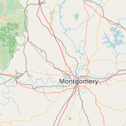
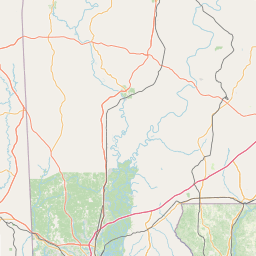
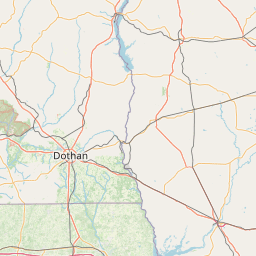
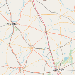
Distance Map Between Selma and Dothan
Selma, Montgomery, United States ↔ Dothan, Montgomery, United States = 126 miles = 203 km.


How far is it between Selma and Dothan
Selma is located in United States with (32.4074,-87.0211) coordinates and Dothan is located in United States with (31.2232,-85.3905) coordinates. The calculated flying distance from Selma to Dothan is equal to 126 miles which is equal to 203 km.
If you want to go by car, the driving distance between Selma and Dothan is 225.46 km. If you ride your car with an average speed of 112 kilometers/hour (70 miles/h), travel time will be 02 hours 00 minutes. Please check the avg. speed travel time table on the right for various options.
Difference between fly and go by a car is 22 km.
| City/Place | Latitude and Longitude | GPS Coordinates |
|---|---|---|
| Selma | 32.4074, -87.0211 | 32° 24´ 26.4960'' N 87° 1´ 15.9600'' W |
| Dothan | 31.2232, -85.3905 | 31° 13´ 23.6280'' N 85° 23´ 25.7640'' W |
Estimated Travel Time Between Selma and Dothan
| Average Speed | Travel Time |
|---|---|
| 30 mph (48 km/h) | 04 hours 41 minutes |
| 40 mph (64 km/h) | 03 hours 31 minutes |
| 50 mph (80 km/h) | 02 hours 49 minutes |
| 60 mph (97 km/h) | 02 hours 19 minutes |
| 70 mph (112 km/h) | 02 hours 00 minutes |
| 75 mph (120 km/h) | 01 hours 52 minutes |
Related Distances from Selma
| Cities | Distance |
|---|---|
| Selma 2 to Mobile | 255 km |
| Selma 2 to Birmingham 2 | 142 km |
| Selma 2 to Huntsville | 300 km |
| Selma 2 to Prattville | 60 km |
| Selma 2 to Decatur 2 | 277 km |
Related Distances to Dothan
| Cities | Distance |
|---|---|
| Enterprise 2 to Dothan | 48 km |
| Mobile to Dothan | 309 km |
| Auburn 2 to Dothan | 187 km |
| Tuscaloosa to Dothan | 337 km |
| Troy 4 to Dothan | 90 km |