Distance from Sendhwa to Shamgarh
Distance between Sendhwa and Shamgarh is 284 kilometers (176 miles).
Driving distance from Sendhwa to Shamgarh is 381 kilometers (237 miles).
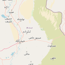
Distance Map Between Sendhwa and Shamgarh
Sendhwa, Bhopal, India ↔ Shamgarh, Bhopal, India = 176 miles = 284 km.


How far is it between Sendhwa and Shāmgarh
Sendhwa is located in India with (21.6859,75.0975) coordinates and Shamgarh is located in India with (24.1882,75.639) coordinates. The calculated flying distance from Sendhwa to Shamgarh is equal to 176 miles which is equal to 284 km.
If you want to go by car, the driving distance between Sendhwa and Shamgarh is 381.16 km. If you ride your car with an average speed of 112 kilometers/hour (70 miles/h), travel time will be 03 hours 24 minutes. Please check the avg. speed travel time table on the right for various options.
Difference between fly and go by a car is 97 km.
| City/Place | Latitude and Longitude | GPS Coordinates |
|---|---|---|
| Sendhwa | 21.6859, 75.0975 | 21° 41´ 9.0960'' N 75° 5´ 51.0000'' E |
| Shamgarh | 24.1882, 75.639 | 24° 11´ 17.4120'' N 75° 38´ 20.5080'' E |
Estimated Travel Time Between Sendhwa and Shāmgarh
| Average Speed | Travel Time |
|---|---|
| 30 mph (48 km/h) | 07 hours 56 minutes |
| 40 mph (64 km/h) | 05 hours 57 minutes |
| 50 mph (80 km/h) | 04 hours 45 minutes |
| 60 mph (97 km/h) | 03 hours 55 minutes |
| 70 mph (112 km/h) | 03 hours 24 minutes |
| 75 mph (120 km/h) | 03 hours 10 minutes |
Related Distances from Sendhwa
| Cities | Distance |
|---|---|
| Sendhwa to Ujjain | 216 km |
| Sendhwa to Shajapur | 259 km |
| Sendhwa to Vidisha | 403 km |
| Sendhwa to Udaipura | 495 km |
| Sendhwa to Sheopur | 556 km |
Related Distances to Shamgarh
| Cities | Distance |
|---|---|
| Agar to Shamgarh | 97 km |
| Mandsaur to Shamgarh | 75 km |
| Jaora to Shamgarh | 109 km |
| Indore to Shamgarh | 213 km |
| Ratlam to Shamgarh | 148 km |