Distance from Shantou to Xiongzhou
Distance between Shantou and Xiongzhou is 313 kilometers (194 miles).
Driving distance from Shantou to Xiongzhou is 572 kilometers (356 miles).
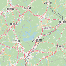
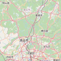
Distance Map Between Shantou and Xiongzhou
Shantou, Guangzhou, China ↔ Xiongzhou, Guangzhou, China = 194 miles = 313 km.


How far is it between Shantou and Xiongzhou
Shantou is located in China with (23.3681,116.7148) coordinates and Xiongzhou is located in China with (25.1167,114.3) coordinates. The calculated flying distance from Shantou to Xiongzhou is equal to 194 miles which is equal to 313 km.
If you want to go by car, the driving distance between Shantou and Xiongzhou is 572.18 km. If you ride your car with an average speed of 112 kilometers/hour (70 miles/h), travel time will be 05 hours 06 minutes. Please check the avg. speed travel time table on the right for various options.
Difference between fly and go by a car is 259 km.
| City/Place | Latitude and Longitude | GPS Coordinates |
|---|---|---|
| Shantou | 23.3681, 116.7148 | 23° 22´ 5.3040'' N 116° 42´ 53.2440'' E |
| Xiongzhou | 25.1167, 114.3 | 25° 7´ 0.0120'' N 114° 17´ 60.0000'' E |
Estimated Travel Time Between Shantou and Xiongzhou
| Average Speed | Travel Time |
|---|---|
| 30 mph (48 km/h) | 11 hours 55 minutes |
| 40 mph (64 km/h) | 08 hours 56 minutes |
| 50 mph (80 km/h) | 07 hours 09 minutes |
| 60 mph (97 km/h) | 05 hours 53 minutes |
| 70 mph (112 km/h) | 05 hours 06 minutes |
| 75 mph (120 km/h) | 04 hours 46 minutes |
Related Distances from Shantou
| Cities | Distance |
|---|---|
| Shantou to Fuzhou | 498 km |
| Shantou to Heyuan | 293 km |
| Shantou to Sanshui | 488 km |
| Shantou to Shanwei | 199 km |
| Shantou to Shaoguan | 576 km |
| Shantou to Shaping | 472 km |
| Shantou to Shenzhen | 337 km |
| Shantou to Shilong | 373 km |
| Shantou to Shiqi | 445 km |
| Shantou to Shiqiao | 440 km |
Related Distances to Xiongzhou
| Cities | Distance |
|---|---|
| Jiangmen to Xiongzhou | 409 km |
| Shilong to Xiongzhou | 361 km |
| Shanwei to Xiongzhou | 520 km |
| Huizhou to Xiongzhou | 417 km |
| Danshui to Xiongzhou | 429 km |
| Luoyang 2 to Xiongzhou | 378 km |
| Yangjiang to Xiongzhou | 522 km |
| Xinyi to Xiongzhou | 619 km |
| Shaoguan to Xiongzhou | 98 km |
| Gaozhou to Xiongzhou | 670 km |