Distance from Sheridan to Anmore
Distance between Sheridan and Anmore is 1302 kilometers (809 miles).
Driving distance from Sheridan to Anmore is 1738 kilometers (1080 miles).
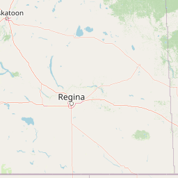
Distance Map Between Sheridan and Anmore
Sheridan, Cheyenne, United States ↔ Anmore, Victoria, Canada = 809 miles = 1302 km.


How far is it between Sheridan and Anmore
Sheridan is located in United States with (44.7972,-106.9562) coordinates and Anmore is located in Canada with (49.3164,-122.8526) coordinates. The calculated flying distance from Sheridan to Anmore is equal to 809 miles which is equal to 1302 km.
If you want to go by car, the driving distance between Sheridan and Anmore is 1738.08 km. If you ride your car with an average speed of 112 kilometers/hour (70 miles/h), travel time will be 15 hours 31 minutes. Please check the avg. speed travel time table on the right for various options.
Difference between fly and go by a car is 436 km.
| City/Place | Latitude and Longitude | GPS Coordinates |
|---|---|---|
| Sheridan | 44.7972, -106.9562 | 44° 47´ 49.8840'' N 106° 57´ 22.2480'' W |
| Anmore | 49.3164, -122.8526 | 49° 18´ 58.9320'' N 122° 51´ 9.4680'' W |
Estimated Travel Time Between Sheridan and Anmore
| Average Speed | Travel Time |
|---|---|
| 30 mph (48 km/h) | 36 hours 12 minutes |
| 40 mph (64 km/h) | 27 hours 09 minutes |
| 50 mph (80 km/h) | 21 hours 43 minutes |
| 60 mph (97 km/h) | 17 hours 55 minutes |
| 70 mph (112 km/h) | 15 hours 31 minutes |
| 75 mph (120 km/h) | 14 hours 29 minutes |
Related Distances from Sheridan
| Cities | Distance |
|---|---|
| Sheridan to Calgary | 1070 km |
| Sheridan to Surrey | 1706 km |
| Sheridan to Kelowna | 1445 km |
| Sheridan to Regina | 848 km |
| Sheridan to Ontario | 1932 km |
Related Distances to Anmore
| Cities | Distance |
|---|---|
| Hillsboro to Anmore | 532 km |
| Kent to Anmore | 251 km |
| Vancouver 2 to Anmore | 488 km |
| Juneau to Anmore | 2634 km |
| Helena to Anmore | 1158 km |