Distance from Sherkot to Sitapur
Distance between Sherkot and Sitapur is 285 kilometers (177 miles).
Driving distance from Sherkot to Sitapur is 338 kilometers (210 miles).
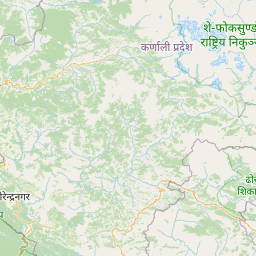
Distance Map Between Sherkot and Sitapur
Sherkot, Lucknow, India ↔ Sitapur, Lucknow, India = 177 miles = 285 km.


How far is it between Sherkot and Sītāpur
Sherkot is located in India with (29.3263,78.5745) coordinates and Sitapur is located in India with (27.5619,80.6827) coordinates. The calculated flying distance from Sherkot to Sitapur is equal to 177 miles which is equal to 285 km.
If you want to go by car, the driving distance between Sherkot and Sitapur is 337.64 km. If you ride your car with an average speed of 112 kilometers/hour (70 miles/h), travel time will be 03 hours 00 minutes. Please check the avg. speed travel time table on the right for various options.
Difference between fly and go by a car is 53 km.
| City/Place | Latitude and Longitude | GPS Coordinates |
|---|---|---|
| Sherkot | 29.3263, 78.5745 | 29° 19´ 34.5720'' N 78° 34´ 28.1280'' E |
| Sitapur | 27.5619, 80.6827 | 27° 33´ 42.9120'' N 80° 40´ 57.5400'' E |
Estimated Travel Time Between Sherkot and Sītāpur
| Average Speed | Travel Time |
|---|---|
| 30 mph (48 km/h) | 07 hours 02 minutes |
| 40 mph (64 km/h) | 05 hours 16 minutes |
| 50 mph (80 km/h) | 04 hours 13 minutes |
| 60 mph (97 km/h) | 03 hours 28 minutes |
| 70 mph (112 km/h) | 03 hours 00 minutes |
| 75 mph (120 km/h) | 02 hours 48 minutes |
Related Distances from Sherkot
| Cities | Distance |
|---|---|
| Sherkot to Thakurdwara | 40 km |
| Sherkot to Thana Bhawan | 141 km |
| Sherkot to Sultanpur | 607 km |
| Sherkot to Varanasi | 772 km |
| Sherkot to Shikarpur 2 | 169 km |
Related Distances to Sitapur
| Cities | Distance |
|---|---|
| Sidhauli to Sitapur | 41 km |
| Maholi to Sitapur | 25 km |
| Laharpur to Sitapur | 34 km |
| Sandila to Sitapur | 71 km |
| Mahmudabad to Sitapur | 66 km |