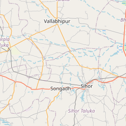
Distance from Sihor to Talaja
Distance between Sihor and Talaja is 41 kilometers (25 miles).
Driving distance from Sihor to Talaja is 51 kilometers (32 miles).
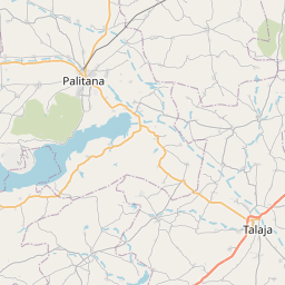
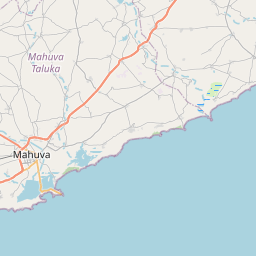
Distance Map Between Sihor and Talaja
Sihor, Ghandinagar, India ↔ Talaja, Ghandinagar, India = 25 miles = 41 km.
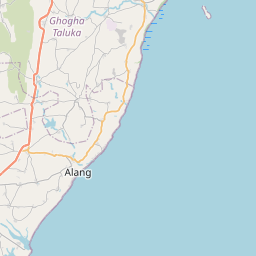


How far is it between Sihor and Talāja
Sihor is located in India with (21.7113,71.9618) coordinates and Talaja is located in India with (21.3527,72.0352) coordinates. The calculated flying distance from Sihor to Talaja is equal to 25 miles which is equal to 41 km.
If you want to go by car, the driving distance between Sihor and Talaja is 51.29 km. If you ride your car with an average speed of 112 kilometers/hour (70 miles/h), travel time will be 00 hours 27 minutes. Please check the avg. speed travel time table on the right for various options.
Difference between fly and go by a car is 10 km.
| City/Place | Latitude and Longitude | GPS Coordinates |
|---|---|---|
| Sihor | 21.7113, 71.9618 | 21° 42´ 40.8240'' N 71° 57´ 42.4440'' E |
| Talaja | 21.3527, 72.0352 | 21° 21´ 9.7200'' N 72° 2´ 6.8640'' E |
Estimated Travel Time Between Sihor and Talāja
| Average Speed | Travel Time |
|---|---|
| 30 mph (48 km/h) | 01 hours 04 minutes |
| 40 mph (64 km/h) | 00 hours 48 minutes |
| 50 mph (80 km/h) | 00 hours 38 minutes |
| 60 mph (97 km/h) | 00 hours 31 minutes |
| 70 mph (112 km/h) | 00 hours 27 minutes |
| 75 mph (120 km/h) | 00 hours 25 minutes |
Related Distances from Sihor
| Cities | Distance |
|---|---|
| Sihor to Talaja | 51 km |
| Sihor to Sikka | 272 km |
| Sihor to Surat | 345 km |
| Sihor to Songadh | 432 km |
| Sihor to Valsad | 417 km |
Related Distances to Talaja
| Cities | Distance |
|---|---|
| Bhavnagar to Talaja | 54 km |
| Rajkot to Talaja | 191 km |
| Surat to Talaja | 387 km |
| Palitana to Talaja | 35 km |
| Ahmedabad to Talaja | 226 km |