Distance from Sihora to Umaria
Distance between Sihora and Umaria is 75 kilometers (47 miles).
Driving distance from Sihora to Umaria is 114 kilometers (71 miles).
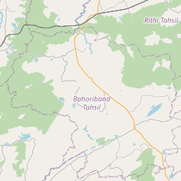
Distance Map Between Sihora and Umaria
Sihora, Bhopal, India ↔ Umaria, Bhopal, India = 47 miles = 75 km.


How far is it between Sihorā and Umariā
Sihora is located in India with (23.4887,80.1035) coordinates and Umaria is located in India with (23.5268,80.8375) coordinates. The calculated flying distance from Sihora to Umaria is equal to 47 miles which is equal to 75 km.
If you want to go by car, the driving distance between Sihora and Umaria is 114.49 km. If you ride your car with an average speed of 112 kilometers/hour (70 miles/h), travel time will be 01 hours 01 minutes. Please check the avg. speed travel time table on the right for various options.
Difference between fly and go by a car is 39 km.
| City/Place | Latitude and Longitude | GPS Coordinates |
|---|---|---|
| Sihora | 23.4887, 80.1035 | 23° 29´ 19.3560'' N 80° 6´ 12.5280'' E |
| Umaria | 23.5268, 80.8375 | 23° 31´ 36.6240'' N 80° 50´ 14.8200'' E |
Estimated Travel Time Between Sihorā and Umariā
| Average Speed | Travel Time |
|---|---|
| 30 mph (48 km/h) | 02 hours 23 minutes |
| 40 mph (64 km/h) | 01 hours 47 minutes |
| 50 mph (80 km/h) | 01 hours 25 minutes |
| 60 mph (97 km/h) | 01 hours 10 minutes |
| 70 mph (112 km/h) | 01 hours 01 minutes |
| 75 mph (120 km/h) | 00 hours 57 minutes |
Related Distances from Sihora
| Cities | Distance |
|---|---|
| Sihora to Umaria | 114 km |
| Sihora to Waraseoni | 277 km |
| Sihora to Udaipura | 196 km |
| Sihora to Ujjain | 532 km |
| Sihora to Vidisha | 284 km |
Related Distances to Umaria
| Cities | Distance |
|---|---|
| Beohari to Umaria | 90 km |
| Mandla to Umaria | 156 km |
| Jabalpur to Umaria | 138 km |
| Rewa to Umaria | 171 km |
| Amarpatan to Umaria | 154 km |