Distance from Sirohi to Sojat
Distance between Sirohi and Sojat is 142 kilometers (88 miles).
Driving distance from Sirohi to Sojat is 152 kilometers (95 miles).
Distance Map Between Sirohi and Sojat
Sirohi, Jaipur, India ↔ Sojat, Jaipur, India = 88 miles = 142 km.


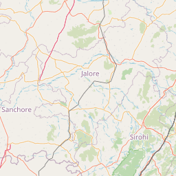


How far is it between Sirohi and Sojat
Sirohi is located in India with (24.8884,72.8479) coordinates and Sojat is located in India with (25.9249,73.6663) coordinates. The calculated flying distance from Sirohi to Sojat is equal to 88 miles which is equal to 142 km.
If you want to go by car, the driving distance between Sirohi and Sojat is 152.47 km. If you ride your car with an average speed of 112 kilometers/hour (70 miles/h), travel time will be 01 hours 21 minutes. Please check the avg. speed travel time table on the right for various options.
Difference between fly and go by a car is 10 km.
| City/Place | Latitude and Longitude | GPS Coordinates |
|---|---|---|
| Sirohi | 24.8884, 72.8479 | 24° 53´ 18.1680'' N 72° 50´ 52.5840'' E |
| Sojat | 25.9249, 73.6663 | 25° 55´ 29.7480'' N 73° 39´ 58.7880'' E |
Estimated Travel Time Between Sirohi and Sojat
| Average Speed | Travel Time |
|---|---|
| 30 mph (48 km/h) | 03 hours 10 minutes |
| 40 mph (64 km/h) | 02 hours 22 minutes |
| 50 mph (80 km/h) | 01 hours 54 minutes |
| 60 mph (97 km/h) | 01 hours 34 minutes |
| 70 mph (112 km/h) | 01 hours 21 minutes |
| 75 mph (120 km/h) | 01 hours 16 minutes |
Related Distances from Sirohi
| Cities | Distance |
|---|---|
| Sirohi to Udaipur | 134 km |
| Sirohi to Sojat | 152 km |
| Sirohi to Udaipur 2 | 492 km |
| Sirohi to Siwana | 124 km |
| Sirohi to Takhatgarh | 76 km |
Related Distances to Sojat
| Cities | Distance |
|---|---|
| Pali to Sojat | 40 km |
| Jodhpur to Sojat | 115 km |
| Bilara to Sojat | 31 km |
| Jaitaran to Sojat | 51 km |
| Sirohi to Sojat | 152 km |