Distance from Stevenage to Ware
Distance between Stevenage and Ware is 16 kilometers (10 miles).
Driving distance from Stevenage to Ware is 19 kilometers (12 miles).
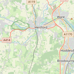
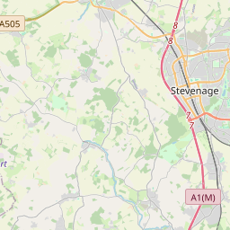
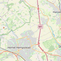
Distance Map Between Stevenage and Ware
Stevenage, London, United Kingdom ↔ Ware, London, United Kingdom = 10 miles = 16 km.


How far is it between Stevenage and Ware
Stevenage is located in United Kingdom with (51.9022,-0.2026) coordinates and Ware is located in United Kingdom with (51.8106,-0.0288) coordinates. The calculated flying distance from Stevenage to Ware is equal to 10 miles which is equal to 16 km.
If you want to go by car, the driving distance between Stevenage and Ware is 18.61 km. If you ride your car with an average speed of 112 kilometers/hour (70 miles/h), travel time will be 00 hours 09 minutes. Please check the avg. speed travel time table on the right for various options.
Difference between fly and go by a car is 3 km.
| City/Place | Latitude and Longitude | GPS Coordinates |
|---|---|---|
| Stevenage | 51.9022, -0.2026 | 51° 54´ 8.0640'' N 0° 12´ 9.2160'' W |
| Ware | 51.8106, -0.0288 | 51° 48´ 38.0880'' N 0° 1´ 43.5000'' W |
Estimated Travel Time Between Stevenage and Ware
| Average Speed | Travel Time |
|---|---|
| 30 mph (48 km/h) | 00 hours 23 minutes |
| 40 mph (64 km/h) | 00 hours 17 minutes |
| 50 mph (80 km/h) | 00 hours 13 minutes |
| 60 mph (97 km/h) | 00 hours 11 minutes |
| 70 mph (112 km/h) | 00 hours 09 minutes |
| 75 mph (120 km/h) | 00 hours 09 minutes |
Related Distances from Stevenage
| Cities | Distance |
|---|---|
| Stevenage to Watford | 39 km |
| Stevenage to Welwyn Garden City | 14 km |
| Stevenage to Ware | 19 km |
| Stevenage to Luton | 24 km |
| Stevenage to Windsor 3 | 72 km |
Related Distances to Ware
| Cities | Distance |
|---|---|
| Harlow to Ware | 14 km |
| City Of London to Ware | 58 km |
| Stevenage to Ware | 19 km |
| St Albans to Ware | 27 km |
| Luton to Ware | 36 km |