Distance from Stoughton to Needham
Distance between Stoughton and Needham is 21 kilometers (13 miles).
Driving distance from Stoughton to Needham is 29 kilometers (18 miles).
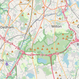
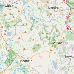
Distance Map Between Stoughton and Needham
Stoughton, Boston, United States ↔ Needham, Boston, United States = 13 miles = 21 km.
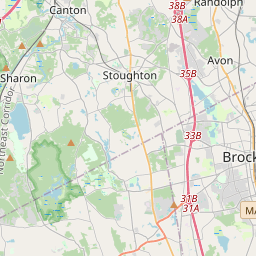


How far is it between Stoughton and Needham
Stoughton is located in United States with (42.1251,-71.1023) coordinates and Needham is located in United States with (42.2834,-71.2328) coordinates. The calculated flying distance from Stoughton to Needham is equal to 13 miles which is equal to 21 km.
If you want to go by car, the driving distance between Stoughton and Needham is 28.61 km. If you ride your car with an average speed of 112 kilometers/hour (70 miles/h), travel time will be 00 hours 15 minutes. Please check the avg. speed travel time table on the right for various options.
Difference between fly and go by a car is 8 km.
| City/Place | Latitude and Longitude | GPS Coordinates |
|---|---|---|
| Stoughton | 42.1251, -71.1023 | 42° 7´ 30.3600'' N 71° 6´ 8.1720'' W |
| Needham | 42.2834, -71.2328 | 42° 17´ 0.3480'' N 71° 13´ 58.1880'' W |
Estimated Travel Time Between Stoughton and Needham
| Average Speed | Travel Time |
|---|---|
| 30 mph (48 km/h) | 00 hours 35 minutes |
| 40 mph (64 km/h) | 00 hours 26 minutes |
| 50 mph (80 km/h) | 00 hours 21 minutes |
| 60 mph (97 km/h) | 00 hours 17 minutes |
| 70 mph (112 km/h) | 00 hours 15 minutes |
| 75 mph (120 km/h) | 00 hours 14 minutes |
Related Distances from Stoughton
| Cities | Distance |
|---|---|
| Stoughton to Randolph | 8 km |
| Stoughton to Burlington 5 | 58 km |
| Stoughton to Cambridge 3 | 39 km |
| Stoughton to Framingham | 52 km |
| Stoughton to Natick | 39 km |
Related Distances to Needham
| Cities | Distance |
|---|---|
| Newton to Needham | 9 km |
| Waltham to Needham | 15 km |
| Norton 2 to Needham | 47 km |
| Reading 3 to Needham | 41 km |
| Norwood to Needham | 14 km |