Distance from Strezhevoy to Stepnogorsk
Distance between Strezhevoy and Stepnogorsk is 994 kilometers (618 miles).
Driving distance from Strezhevoy to Stepnogorsk is 1780 kilometers (1106 miles).
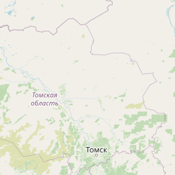
Distance Map Between Strezhevoy and Stepnogorsk
Strezhevoy, Tomsk, Russia ↔ Stepnogorsk, Kokshetau, Kazakhstan = 618 miles = 994 km.


How far is it between Strezhevoy and Stepnogorsk
Strezhevoy is located in Russia with (60.7333,77.5889) coordinates and Stepnogorsk is located in Kazakhstan with (52.3553,71.8864) coordinates. The calculated flying distance from Strezhevoy to Stepnogorsk is equal to 618 miles which is equal to 994 km.
If you want to go by car, the driving distance between Strezhevoy and Stepnogorsk is 1779.74 km. If you ride your car with an average speed of 112 kilometers/hour (70 miles/h), travel time will be 15 hours 53 minutes. Please check the avg. speed travel time table on the right for various options.
Difference between fly and go by a car is 786 km.
| City/Place | Latitude and Longitude | GPS Coordinates |
|---|---|---|
| Strezhevoy | 60.7333, 77.5889 | 60° 43´ 59.8800'' N 77° 35´ 20.0400'' E |
| Stepnogorsk | 52.3553, 71.8864 | 52° 21´ 19.1880'' N 71° 53´ 11.0760'' E |
Estimated Travel Time Between Strezhevoy and Stepnogorsk
| Average Speed | Travel Time |
|---|---|
| 30 mph (48 km/h) | 37 hours 04 minutes |
| 40 mph (64 km/h) | 27 hours 48 minutes |
| 50 mph (80 km/h) | 22 hours 14 minutes |
| 60 mph (97 km/h) | 18 hours 20 minutes |
| 70 mph (112 km/h) | 15 hours 53 minutes |
| 75 mph (120 km/h) | 14 hours 49 minutes |
Related Distances from Strezhevoy
| Cities | Distance |
|---|---|
| Strezhevoy to Pavlodar | 1873 km |
| Strezhevoy to Stepnogorsk | 1780 km |
| Strezhevoy to Temirtau | 2023 km |
| Strezhevoy to Zyryanovsk | 2592 km |
| Strezhevoy to Rudnyy | 1776 km |
Related Distances to Stepnogorsk
| Cities | Distance |
|---|---|
| Salekhard to Stepnogorsk | 2877 km |
| Strezhevoy to Stepnogorsk | 1780 km |
| Yekaterinburg to Stepnogorsk | 1118 km |
| Yugorsk to Stepnogorsk | 1798 km |
| Chelyabinsk to Stepnogorsk | 1022 km |