Distance from Sylvania to Athens
Distance between Sylvania and Athens is 299 kilometers (186 miles).
Driving distance from Sylvania to Athens is 362 kilometers (225 miles).
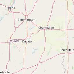
Distance Map Between Sylvania and Athens
Sylvania, Columbus, United States ↔ Athens, Columbus, United States = 186 miles = 299 km.


How far is it between Sylvania and Athens
Sylvania is located in United States with (41.7189,-83.713) coordinates and Athens is located in United States with (39.3292,-82.1013) coordinates. The calculated flying distance from Sylvania to Athens is equal to 186 miles which is equal to 299 km.
If you want to go by car, the driving distance between Sylvania and Athens is 362.05 km. If you ride your car with an average speed of 112 kilometers/hour (70 miles/h), travel time will be 03 hours 13 minutes. Please check the avg. speed travel time table on the right for various options.
Difference between fly and go by a car is 63 km.
| City/Place | Latitude and Longitude | GPS Coordinates |
|---|---|---|
| Sylvania | 41.7189, -83.713 | 41° 43´ 8.1840'' N 83° 42´ 46.7640'' W |
| Athens | 39.3292, -82.1013 | 39° 19´ 45.2640'' N 82° 6´ 4.5360'' W |
Estimated Travel Time Between Sylvania and Athens
| Average Speed | Travel Time |
|---|---|
| 30 mph (48 km/h) | 07 hours 32 minutes |
| 40 mph (64 km/h) | 05 hours 39 minutes |
| 50 mph (80 km/h) | 04 hours 31 minutes |
| 60 mph (97 km/h) | 03 hours 43 minutes |
| 70 mph (112 km/h) | 03 hours 13 minutes |
| 75 mph (120 km/h) | 03 hours 01 minutes |
Related Distances from Sylvania
| Cities | Distance |
|---|---|
| Sylvania to Delaware | 197 km |
| Sylvania to Bowling Green 2 | 44 km |
| Sylvania to Perrysburg | 27 km |
| Sylvania to Cleveland | 208 km |
| Sylvania to Cincinnati | 328 km |
Related Distances to Athens
| Cities | Distance |
|---|---|
| Berea to Athens 3 | 325 km |
| Troy 3 to Athens 3 | 234 km |
| Youngstown to Athens 3 | 365 km |
| Kent 2 to Athens 3 | 309 km |
| Cincinnati to Athens 3 | 273 km |