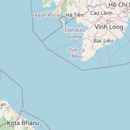
Distance from Takeo to Kabanjahe
Distance between Takeo and Kabanjahe is 1119 kilometers (695 miles).
Driving distance from Takeo to Kabanjahe is 3349 kilometers (2081 miles).
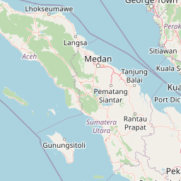
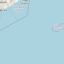
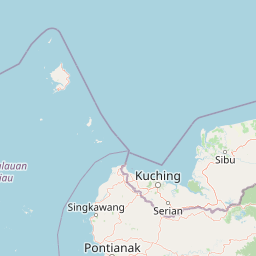
Distance Map Between Takeo and Kabanjahe
Takeo, Cambodia ↔ Kabanjahe, Medan, Indonesia = 695 miles = 1119 km.


How far is it between Takeo and Kabanjahe
Takeo is located in Cambodia with (10.9908,104.785) coordinates and Kabanjahe is located in Indonesia with (3.1001,98.4908) coordinates. The calculated flying distance from Takeo to Kabanjahe is equal to 695 miles which is equal to 1119 km.
If you want to go by car, the driving distance between Takeo and Kabanjahe is 3348.56 km. If you ride your car with an average speed of 112 kilometers/hour (70 miles/h), travel time will be 29 hours 53 minutes. Please check the avg. speed travel time table on the right for various options.
Difference between fly and go by a car is 2230 km.
| City/Place | Latitude and Longitude | GPS Coordinates |
|---|---|---|
| Takeo | 10.9908, 104.785 | 10° 59´ 26.9160'' N 104° 47´ 5.9280'' E |
| Kabanjahe | 3.1001, 98.4908 | 3° 6´ 0.3600'' N 98° 29´ 26.8800'' E |
Estimated Travel Time Between Takeo and Kabanjahe
| Average Speed | Travel Time |
|---|---|
| 30 mph (48 km/h) | 69 hours 45 minutes |
| 40 mph (64 km/h) | 52 hours 19 minutes |
| 50 mph (80 km/h) | 41 hours 51 minutes |
| 60 mph (97 km/h) | 34 hours 31 minutes |
| 70 mph (112 km/h) | 29 hours 53 minutes |
| 75 mph (120 km/h) | 27 hours 54 minutes |
Related Distances from Takeo
| Cities | Distance |
|---|---|
| Takeo to Pontianak | 4572 km |
| Takeo to Padang | 4003 km |
| Takeo to Gorontalo | 6699 km |
| Takeo to Sunggal | 3272 km |
| Takeo to Palu | 6184 km |