Distance from Tawau to Seririt
Distance between Tawau and Seririt is 1421 kilometers (883 miles).
Driving distance from Tawau to Seririt is 3409 kilometers (2118 miles).
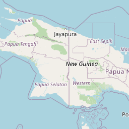
Distance Map Between Tawau and Seririt
Tawau, Kota Kinabalu, Malaysia ↔ Seririt, Denpasar, Indonesia = 883 miles = 1421 km.


How far is it between Tawau and Seririt
Tawau is located in Malaysia with (4.2448,117.8912) coordinates and Seririt is located in Indonesia with (-8.1928,114.9388) coordinates. The calculated flying distance from Tawau to Seririt is equal to 883 miles which is equal to 1421 km.
If you want to go by car, the driving distance between Tawau and Seririt is 3409.26 km. If you ride your car with an average speed of 112 kilometers/hour (70 miles/h), travel time will be 30 hours 26 minutes. Please check the avg. speed travel time table on the right for various options.
Difference between fly and go by a car is 1988 km.
| City/Place | Latitude and Longitude | GPS Coordinates |
|---|---|---|
| Tawau | 4.2448, 117.8912 | 4° 14´ 41.3520'' N 117° 53´ 28.1400'' E |
| Seririt | -8.1928, 114.9388 | 8° 11´ 34.0800'' S 114° 56´ 19.6800'' E |
Estimated Travel Time Between Tawau and Seririt
| Average Speed | Travel Time |
|---|---|
| 30 mph (48 km/h) | 71 hours 01 minutes |
| 40 mph (64 km/h) | 53 hours 16 minutes |
| 50 mph (80 km/h) | 42 hours 36 minutes |
| 60 mph (97 km/h) | 35 hours 08 minutes |
| 70 mph (112 km/h) | 30 hours 26 minutes |
| 75 mph (120 km/h) | 28 hours 24 minutes |
Related Distances from Tawau
| Cities | Distance |
|---|---|
| Tawau to Balung | 3062 km |
| Tawau to Jakarta | 2541 km |
| Tawau to Surabaya | 2871 km |
| Tawau to Ambon | 5417 km |
| Tawau to Mataram | 3420 km |
Related Distances to Seririt
| Cities | Distance |
|---|---|
| Shah Alam to Seririt | 2729 km |
| Johor Bahru to Seririt | 2386 km |
| Ipoh to Seririt | 2918 km |
| Miri to Seririt | 2515 km |
| Klang to Seririt | 2736 km |