Distance from Temuco to Trelew
Distance between Temuco and Trelew is 791 kilometers (491 miles).
Driving distance from Temuco to Trelew is 1230 kilometers (764 miles).
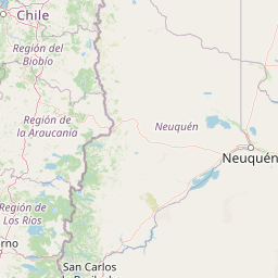
Distance Map Between Temuco and Trelew
Temuco, Chile ↔ Trelew, Rawson, Argentina = 491 miles = 791 km.


How far is it between Temuco and Trelew
Temuco is located in Chile with (-38.7397,-72.5984) coordinates and Trelew is located in Argentina with (-43.249,-65.3051) coordinates. The calculated flying distance from Temuco to Trelew is equal to 491 miles which is equal to 791 km.
If you want to go by car, the driving distance between Temuco and Trelew is 1230.3 km. If you ride your car with an average speed of 112 kilometers/hour (70 miles/h), travel time will be 10 hours 59 minutes. Please check the avg. speed travel time table on the right for various options.
Difference between fly and go by a car is 439 km.
| City/Place | Latitude and Longitude | GPS Coordinates |
|---|---|---|
| Temuco | -38.7397, -72.5984 | 38° 44´ 22.7400'' S 72° 35´ 54.3120'' W |
| Trelew | -43.249, -65.3051 | 43° 14´ 56.2200'' S 65° 18´ 18.1800'' W |
Estimated Travel Time Between Temuco and Trelew
| Average Speed | Travel Time |
|---|---|
| 30 mph (48 km/h) | 25 hours 37 minutes |
| 40 mph (64 km/h) | 19 hours 13 minutes |
| 50 mph (80 km/h) | 15 hours 22 minutes |
| 60 mph (97 km/h) | 12 hours 41 minutes |
| 70 mph (112 km/h) | 10 hours 59 minutes |
| 75 mph (120 km/h) | 10 hours 15 minutes |
Related Distances from Temuco
| Cities | Distance |
|---|---|
| Temuco to San Martin De Los Andes | 287 km |
| Temuco to Rawson | 1248 km |
| Temuco to Quilmes | 1684 km |
| Temuco to San Carlos De Bariloche | 490 km |
| Temuco to Buenos Aires | 1665 km |
Related Distances to Trelew
| Cities | Distance |
|---|---|
| Santiago to Trelew | 1817 km |
| Punta Arenas to Trelew | 1407 km |
| Vina Del Mar to Trelew | 1929 km |
| Puerto Natales to Trelew | 1370 km |
| Valparaiso to Trelew | 1926 km |