Distance from Tokmok to Kabul
Distance between Tokmok and Kabul is 1066 kilometers (662 miles).
Driving distance from Tokmok to Kabul is 1844 kilometers (1146 miles).
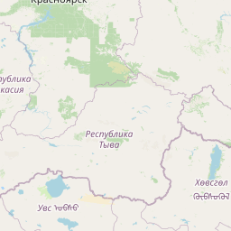
Distance Map Between Tokmok and Kabul
Tokmok, Bishkek, Kyrgyzstan ↔ Kabul, Afghanistan = 662 miles = 1066 km.


How far is it between Tokmok and Kabul
Tokmok is located in Kyrgyzstan with (42.8419,75.3015) coordinates and Kabul is located in Afghanistan with (34.5281,69.1723) coordinates. The calculated flying distance from Tokmok to Kabul is equal to 662 miles which is equal to 1066 km.
If you want to go by car, the driving distance between Tokmok and Kabul is 1844.33 km. If you ride your car with an average speed of 112 kilometers/hour (70 miles/h), travel time will be 16 hours 28 minutes. Please check the avg. speed travel time table on the right for various options.
Difference between fly and go by a car is 778 km.
| City/Place | Latitude and Longitude | GPS Coordinates |
|---|---|---|
| Tokmok | 42.8419, 75.3015 | 42° 50´ 30.9840'' N 75° 18´ 5.3640'' E |
| Kabul | 34.5281, 69.1723 | 34° 31´ 41.2680'' N 69° 10´ 20.3880'' E |
Estimated Travel Time Between Tokmok and Kabul
| Average Speed | Travel Time |
|---|---|
| 30 mph (48 km/h) | 38 hours 25 minutes |
| 40 mph (64 km/h) | 28 hours 49 minutes |
| 50 mph (80 km/h) | 23 hours 03 minutes |
| 60 mph (97 km/h) | 19 hours 00 minutes |
| 70 mph (112 km/h) | 16 hours 28 minutes |
| 75 mph (120 km/h) | 15 hours 22 minutes |
Related Distances to Kabul
| Cities | Distance |
|---|---|
| Bishkek to Kabul | 1619 km |
| Jalal Abad to Kabul | 1231 km |
| Osh to Kabul | 1231 km |
| Naryn to Kabul | 1560 km |
| Talas 2 to Kabul | 1525 km |