Distance from Toledo to Stow
Distance between Toledo and Stow is 185 kilometers (115 miles).
Driving distance from Toledo to Stow is 216 kilometers (134 miles).
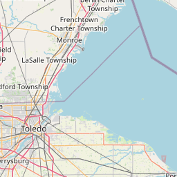
Distance Map Between Toledo and Stow
Toledo, Columbus, United States ↔ Stow, Columbus, United States = 115 miles = 185 km.


How far is it between Toledo and Stow
Toledo is located in United States with (41.6639,-83.5552) coordinates and Stow is located in United States with (41.1595,-81.4404) coordinates. The calculated flying distance from Toledo to Stow is equal to 115 miles which is equal to 185 km.
If you want to go by car, the driving distance between Toledo and Stow is 215.51 km. If you ride your car with an average speed of 112 kilometers/hour (70 miles/h), travel time will be 01 hours 55 minutes. Please check the avg. speed travel time table on the right for various options.
Difference between fly and go by a car is 31 km.
| City/Place | Latitude and Longitude | GPS Coordinates |
|---|---|---|
| Toledo | 41.6639, -83.5552 | 41° 39´ 50.1840'' N 83° 33´ 18.7560'' W |
| Stow | 41.1595, -81.4404 | 41° 9´ 34.2000'' N 81° 26´ 25.4040'' W |
Estimated Travel Time Between Toledo and Stow
| Average Speed | Travel Time |
|---|---|
| 30 mph (48 km/h) | 04 hours 29 minutes |
| 40 mph (64 km/h) | 03 hours 22 minutes |
| 50 mph (80 km/h) | 02 hours 41 minutes |
| 60 mph (97 km/h) | 02 hours 13 minutes |
| 70 mph (112 km/h) | 01 hours 55 minutes |
| 75 mph (120 km/h) | 01 hours 47 minutes |
Related Distances from Toledo
| Cities | Distance |
|---|---|
| Toledo to Cincinnati | 319 km |
| Toledo to Lima 2 | 127 km |
| Toledo to Cleveland | 185 km |
| Toledo to Sylvania | 20 km |
| Toledo to Findlay | 76 km |
Related Distances to Stow
| Cities | Distance |
|---|---|
| Willoughby to Stow | 62 km |
| Strongsville to Stow | 51 km |
| Youngstown to Stow | 75 km |
| Twinsburg to Stow | 19 km |
| Tallmadge to Stow | 7 km |