Distance from Topki to Shymkent
Distance between Topki and Shymkent is 1851 kilometers (1150 miles).
Driving distance from Topki to Shymkent is 2663 kilometers (1655 miles).
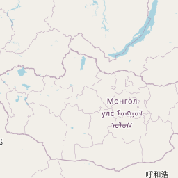
Distance Map Between Topki and Shymkent
Topki, Kemerovo, Russia ↔ Shymkent, Kazakhstan = 1150 miles = 1851 km.


How far is it between Topki and Shymkent
Topki is located in Russia with (55.2769,85.6163) coordinates and Shymkent is located in Kazakhstan with (42.3,69.6) coordinates. The calculated flying distance from Topki to Shymkent is equal to 1150 miles which is equal to 1851 km.
If you want to go by car, the driving distance between Topki and Shymkent is 2663.32 km. If you ride your car with an average speed of 112 kilometers/hour (70 miles/h), travel time will be 23 hours 46 minutes. Please check the avg. speed travel time table on the right for various options.
Difference between fly and go by a car is 812 km.
| City/Place | Latitude and Longitude | GPS Coordinates |
|---|---|---|
| Topki | 55.2769, 85.6163 | 55° 16´ 36.8400'' N 85° 36´ 58.6800'' E |
| Shymkent | 42.3, 69.6 | 42° 17´ 60.0000'' N 69° 35´ 60.0000'' E |
Estimated Travel Time Between Topki and Shymkent
| Average Speed | Travel Time |
|---|---|
| 30 mph (48 km/h) | 55 hours 29 minutes |
| 40 mph (64 km/h) | 41 hours 36 minutes |
| 50 mph (80 km/h) | 33 hours 17 minutes |
| 60 mph (97 km/h) | 27 hours 27 minutes |
| 70 mph (112 km/h) | 23 hours 46 minutes |
| 75 mph (120 km/h) | 22 hours 11 minutes |
Related Distances from Topki
| Cities | Distance |
|---|---|
| Topki to Taraz | 2378 km |
| Topki to Almaty | 2014 km |
| Topki to Pavlodar | 809 km |
| Topki to Astana | 1275 km |
| Topki to Semey | 885 km |
Related Distances to Shymkent
| Cities | Distance |
|---|---|
| Snezhinsk to Shymkent | 2144 km |
| Omsk to Shymkent | 2154 km |
| Chelyabinsk to Shymkent | 1997 km |
| Sterlitamak to Shymkent | 2002 km |
| Novosibirsk to Shymkent | 2344 km |