Distance from Troy to Kentwood
Distance between Troy and Kentwood is 206 kilometers (128 miles).
Driving distance from Troy to Kentwood is 248 kilometers (154 miles).
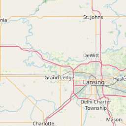
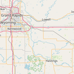
Distance Map Between Troy and Kentwood
Troy, Lansing, United States ↔ Kentwood, Lansing, United States = 128 miles = 206 km.


How far is it between Troy and Kentwood
Troy is located in United States with (42.6056,-83.1499) coordinates and Kentwood is located in United States with (42.8695,-85.6448) coordinates. The calculated flying distance from Troy to Kentwood is equal to 128 miles which is equal to 206 km.
If you want to go by car, the driving distance between Troy and Kentwood is 247.54 km. If you ride your car with an average speed of 112 kilometers/hour (70 miles/h), travel time will be 02 hours 12 minutes. Please check the avg. speed travel time table on the right for various options.
Difference between fly and go by a car is 42 km.
| City/Place | Latitude and Longitude | GPS Coordinates |
|---|---|---|
| Troy | 42.6056, -83.1499 | 42° 36´ 20.1240'' N 83° 8´ 59.7480'' W |
| Kentwood | 42.8695, -85.6448 | 42° 52´ 10.0920'' N 85° 38´ 41.1000'' W |
Estimated Travel Time Between Troy and Kentwood
| Average Speed | Travel Time |
|---|---|
| 30 mph (48 km/h) | 05 hours 09 minutes |
| 40 mph (64 km/h) | 03 hours 52 minutes |
| 50 mph (80 km/h) | 03 hours 05 minutes |
| 60 mph (97 km/h) | 02 hours 33 minutes |
| 70 mph (112 km/h) | 02 hours 12 minutes |
| 75 mph (120 km/h) | 02 hours 03 minutes |
Related Distances from Troy
| Cities | Distance |
|---|---|
| Troy to Detroit | 38 km |
| Troy to Dearborn | 43 km |
| Troy to Sterling Heights | 13 km |
| Troy to Birmingham 3 | 12 km |
| Troy to Novi | 51 km |
Related Distances to Kentwood
| Cities | Distance |
|---|---|
| Wyoming to Kentwood | 11 km |
| Walker to Kentwood | 30 km |
| Oak Park 2 to Kentwood | 233 km |
| Taylor to Kentwood | 254 km |
| Novi to Kentwood | 207 km |