Distance from Union to Clifton
Distance between Union and Clifton is 20 kilometers (12 miles).
Driving distance from Union to Clifton is 26 kilometers (16 miles).
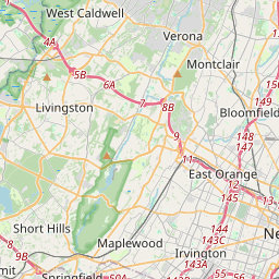
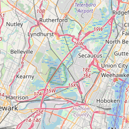
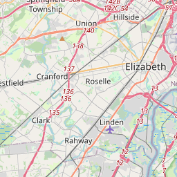
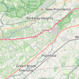
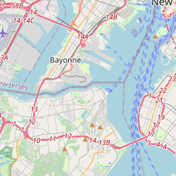
Distance Map Between Union and Clifton
Union, Trenton, United States ↔ Clifton, Trenton, United States = 12 miles = 20 km.


How far is it between Union and Clifton
Union is located in United States with (40.6976,-74.2632) coordinates and Clifton is located in United States with (40.8584,-74.1638) coordinates. The calculated flying distance from Union to Clifton is equal to 12 miles which is equal to 20 km.
If you want to go by car, the driving distance between Union and Clifton is 25.64 km. If you ride your car with an average speed of 112 kilometers/hour (70 miles/h), travel time will be 00 hours 13 minutes. Please check the avg. speed travel time table on the right for various options.
Difference between fly and go by a car is 6 km.
| City/Place | Latitude and Longitude | GPS Coordinates |
|---|---|---|
| Union | 40.6976, -74.2632 | 40° 41´ 51.3600'' N 74° 15´ 47.5200'' W |
| Clifton | 40.8584, -74.1638 | 40° 51´ 30.3480'' N 74° 9´ 49.5360'' W |
Estimated Travel Time Between Union and Clifton
| Average Speed | Travel Time |
|---|---|
| 30 mph (48 km/h) | 00 hours 32 minutes |
| 40 mph (64 km/h) | 00 hours 24 minutes |
| 50 mph (80 km/h) | 00 hours 19 minutes |
| 60 mph (97 km/h) | 00 hours 15 minutes |
| 70 mph (112 km/h) | 00 hours 13 minutes |
| 75 mph (120 km/h) | 00 hours 12 minutes |
Related Distances from Union
| Cities | Distance |
|---|---|
| Union to Newark | 12 km |
| Union to Elizabeth | 7 km |
| Union to Edison | 30 km |
| Union to New Brunswick | 40 km |
| Union to Old Bridge | 38 km |
Related Distances to Clifton
| Cities | Distance |
|---|---|
| Jersey City to Clifton | 24 km |
| North Bergen to Clifton | 22 km |
| Hackensack to Clifton | 19 km |
| Grand Junction to Clifton 2 | 9 km |
| Lyndhurst to Clifton | 9 km |