Distance from Uthal to Zhob
Distance between Uthal and Zhob is 674 kilometers (419 miles).
Driving distance from Uthal to Zhob is 894 kilometers (556 miles).
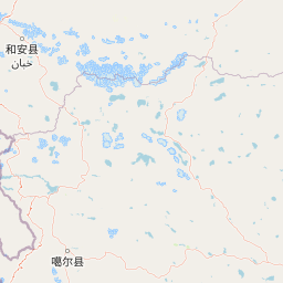
Distance Map Between Uthal and Zhob
Uthal, Quetta, Pakistan ↔ Zhob, Quetta, Pakistan = 419 miles = 674 km.


How far is it between Uthal and Zhob
Uthal is located in Pakistan with (25.8072,66.6219) coordinates and Zhob is located in Pakistan with (31.3411,69.4481) coordinates. The calculated flying distance from Uthal to Zhob is equal to 419 miles which is equal to 674 km.
If you want to go by car, the driving distance between Uthal and Zhob is 894.27 km. If you ride your car with an average speed of 112 kilometers/hour (70 miles/h), travel time will be 07 hours 59 minutes. Please check the avg. speed travel time table on the right for various options.
Difference between fly and go by a car is 220 km.
| City/Place | Latitude and Longitude | GPS Coordinates |
|---|---|---|
| Uthal | 25.8072, 66.6219 | 25° 48´ 25.9920'' N 66° 37´ 18.9840'' E |
| Zhob | 31.3411, 69.4481 | 31° 20´ 27.9960'' N 69° 26´ 53.0160'' E |
Estimated Travel Time Between Uthal and Zhob
| Average Speed | Travel Time |
|---|---|
| 30 mph (48 km/h) | 18 hours 37 minutes |
| 40 mph (64 km/h) | 13 hours 58 minutes |
| 50 mph (80 km/h) | 11 hours 10 minutes |
| 60 mph (97 km/h) | 09 hours 13 minutes |
| 70 mph (112 km/h) | 07 hours 59 minutes |
| 75 mph (120 km/h) | 07 hours 27 minutes |
Related Distances from Uthal
| Cities | Distance |
|---|---|
| Uthal to Turbat | 501 km |
| Uthal to Sibi | 680 km |
| Uthal to Zhob | 894 km |
| Uthal to Usta Muhammad | 691 km |
Related Distances to Zhob
| Cities | Distance |
|---|---|
| Loralai to Zhob | 218 km |
| Gwadar to Zhob | 1429 km |
| Chaman to Zhob | 378 km |
| Pishin to Zhob | 293 km |
| Sibi to Zhob | 497 km |