Distance from Uyo to Umuahia
Distance between Uyo and Umuahia is 72 kilometers (45 miles).
Driving distance from Uyo to Umuahia is 81 kilometers (50 miles).
Distance Map Between Uyo and Umuahia
Uyo, Nigeria ↔ Umuahia, Nigeria = 45 miles = 72 km.
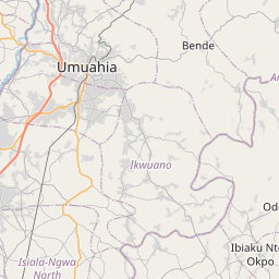
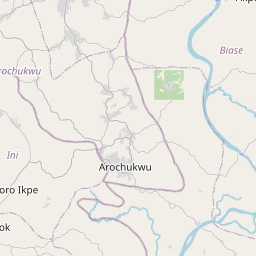
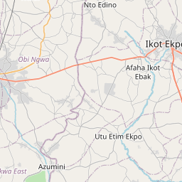
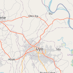
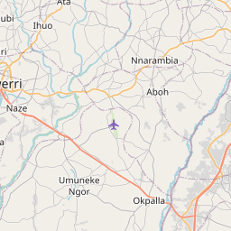

Leaflet | © OpenStreetMap
How far is it between Uyo and Umuahia
Uyo is located in Nigeria with (5.0513,7.9335) coordinates and Umuahia is located in Nigeria with (5.5263,7.4896) coordinates. The calculated flying distance from Uyo to Umuahia is equal to 45 miles which is equal to 72 km.
If you want to go by car, the driving distance between Uyo and Umuahia is 80.84 km. If you ride your car with an average speed of 112 kilometers/hour (70 miles/h), travel time will be 00 hours 43 minutes. Please check the avg. speed travel time table on the right for various options.
Difference between fly and go by a car is 9 km.
| City/Place | Latitude and Longitude | GPS Coordinates |
|---|---|---|
| Uyo | 5.0513, 7.9335 | 5° 3´ 4.5720'' N 7° 56´ 0.6000'' E |
| Umuahia | 5.5263, 7.4896 | 5° 31´ 34.5720'' N 7° 29´ 22.5240'' E |
Estimated Travel Time Between Uyo and Umuahia
| Average Speed | Travel Time |
|---|---|
| 30 mph (48 km/h) | 01 hours 41 minutes |
| 40 mph (64 km/h) | 01 hours 15 minutes |
| 50 mph (80 km/h) | 01 hours 00 minutes |
| 60 mph (97 km/h) | 00 hours 50 minutes |
| 70 mph (112 km/h) | 00 hours 43 minutes |
| 75 mph (120 km/h) | 00 hours 40 minutes |
Uyo, Nigeria
Related Distances from Uyo
| Cities | Distance |
|---|---|
| Uyo to Port Harcourt | 134 km |
| Uyo to Abuja | 677 km |
| Uyo to Umuahia | 81 km |
| Uyo to Yenagoa | 238 km |
| Uyo to Kano | 1066 km |
Umuahia, Nigeria
Related Distances to Umuahia
| Cities | Distance |
|---|---|
| Owerri to Umuahia | 61 km |
| Enugu to Umuahia | 126 km |
| Lagos to Umuahia | 585 km |
| Port Harcourt to Umuahia | 116 km |
| Abuja to Umuahia | 565 km |
Recent Comments
thx. Dis is really helpful