Distance from Valencia to Ibague
Distance between Valencia and Ibague is 1019 kilometers (633 miles).
Driving distance from Valencia to Ibague is 1377 kilometers (855 miles).
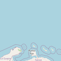
Distance Map Between Valencia and Ibague
Valencia, Venezuela ↔ Ibague, Colombia = 633 miles = 1019 km.


How far is it between Valencia and Ibagué
Valencia is located in Venezuela with (10.162,-68.0077) coordinates and Ibague is located in Colombia with (4.4389,-75.2322) coordinates. The calculated flying distance from Valencia to Ibague is equal to 633 miles which is equal to 1019 km.
If you want to go by car, the driving distance between Valencia and Ibague is 1376.58 km. If you ride your car with an average speed of 112 kilometers/hour (70 miles/h), travel time will be 12 hours 17 minutes. Please check the avg. speed travel time table on the right for various options.
Difference between fly and go by a car is 358 km.
| City/Place | Latitude and Longitude | GPS Coordinates |
|---|---|---|
| Valencia | 10.162, -68.0077 | 10° 9´ 43.2720'' N 68° 0´ 27.5400'' W |
| Ibague | 4.4389, -75.2322 | 4° 26´ 20.0040'' N 75° 13´ 55.9920'' W |
Estimated Travel Time Between Valencia and Ibagué
| Average Speed | Travel Time |
|---|---|
| 30 mph (48 km/h) | 28 hours 40 minutes |
| 40 mph (64 km/h) | 21 hours 30 minutes |
| 50 mph (80 km/h) | 17 hours 12 minutes |
| 60 mph (97 km/h) | 14 hours 11 minutes |
| 70 mph (112 km/h) | 12 hours 17 minutes |
| 75 mph (120 km/h) | 11 hours 28 minutes |
Related Distances from Valencia
| Cities | Distance |
|---|---|
| Valencia to Cartagena | 1143 km |
| Valencia to Malaga 2 | 872 km |
| Valencia to Madrid 2 | 1253 km |
| Valencia to Bogota | 1245 km |
| Valencia to Medellin | 1263 km |
Related Distances to Ibague
| Cities | Distance |
|---|---|
| Valencia to Ibague | 1377 km |
| Maracaibo to Ibague | 1162 km |
| Maracay to Ibague | 1426 km |
| Barquisimeto to Ibague | 1276 km |
| Caracas to Ibague | 1545 km |