Distance from Viersen to Brussels
Distance between Viersen and Brussels is 150 kilometers (93 miles).
Driving distance from Viersen to Brussels is 181 kilometers (112 miles).
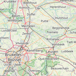
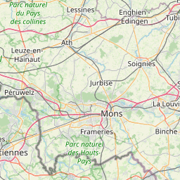
Distance Map Between Viersen and Brussels
Viersen, Dusseldorf, Germany ↔ Brussels, Belgium = 93 miles = 150 km.


How far is it between Viersen and Brussels
Viersen is located in Germany with (51.2544,6.3944) coordinates and Brussels is located in Belgium with (50.8505,4.3488) coordinates. The calculated flying distance from Viersen to Brussels is equal to 93 miles which is equal to 150 km.
If you want to go by car, the driving distance between Viersen and Brussels is 180.9 km. If you ride your car with an average speed of 112 kilometers/hour (70 miles/h), travel time will be 01 hours 36 minutes. Please check the avg. speed travel time table on the right for various options.
Difference between fly and go by a car is 31 km.
| City/Place | Latitude and Longitude | GPS Coordinates |
|---|---|---|
| Viersen | 51.2544, 6.3944 | 51° 15´ 15.6600'' N 6° 23´ 39.8760'' E |
| Brussels | 50.8505, 4.3488 | 50° 51´ 1.6200'' N 4° 20´ 55.6080'' E |
Estimated Travel Time Between Viersen and Brussels
| Average Speed | Travel Time |
|---|---|
| 30 mph (48 km/h) | 03 hours 46 minutes |
| 40 mph (64 km/h) | 02 hours 49 minutes |
| 50 mph (80 km/h) | 02 hours 15 minutes |
| 60 mph (97 km/h) | 01 hours 51 minutes |
| 70 mph (112 km/h) | 01 hours 36 minutes |
| 75 mph (120 km/h) | 01 hours 30 minutes |
Related Distances to Brussels
| Cities | Distance |
|---|---|
| Russelsheim to Brussels | 388 km |
| Wardenburg to Brussels | 463 km |
| Seeheim Jugenheim to Brussels | 419 km |
| Bad Essen to Brussels | 406 km |
| Attendorn to Brussels | 305 km |
| Meckenheim to Brussels | 233 km |
| Kirchlengern to Brussels | 409 km |
| Bingen Am Rhein to Brussels | 356 km |
| Langenfeld to Brussels | 229 km |
| Bad Kreuznach to Brussels | 357 km |