Distance from Walnut Creek to Stockton
Distance between Walnut Creek and Stockton is 68 kilometers (42 miles).
Driving distance from Walnut Creek to Stockton is 105 kilometers (65 miles).
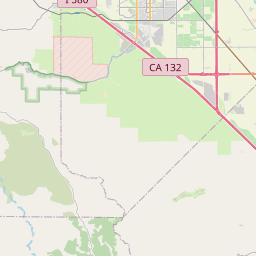
Distance Map Between Walnut Creek and Stockton
Walnut Creek, Sacramento, United States ↔ Stockton, Sacramento, United States = 42 miles = 68 km.


How far is it between Walnut Creek and Stockton
Walnut Creek is located in United States with (37.9063,-122.065) coordinates and Stockton is located in United States with (37.9577,-121.2908) coordinates. The calculated flying distance from Walnut Creek to Stockton is equal to 42 miles which is equal to 68 km.
If you want to go by car, the driving distance between Walnut Creek and Stockton is 104.97 km. If you ride your car with an average speed of 112 kilometers/hour (70 miles/h), travel time will be 00 hours 56 minutes. Please check the avg. speed travel time table on the right for various options.
Difference between fly and go by a car is 37 km.
| City/Place | Latitude and Longitude | GPS Coordinates |
|---|---|---|
| Walnut Creek | 37.9063, -122.065 | 37° 54´ 22.7160'' N 122° 3´ 53.8560'' W |
| Stockton | 37.9577, -121.2908 | 37° 57´ 27.7200'' N 121° 17´ 26.8080'' W |
Estimated Travel Time Between Walnut Creek and Stockton
| Average Speed | Travel Time |
|---|---|
| 30 mph (48 km/h) | 02 hours 11 minutes |
| 40 mph (64 km/h) | 01 hours 38 minutes |
| 50 mph (80 km/h) | 01 hours 18 minutes |
| 60 mph (97 km/h) | 01 hours 04 minutes |
| 70 mph (112 km/h) | 00 hours 56 minutes |
| 75 mph (120 km/h) | 00 hours 52 minutes |
Related Distances from Walnut Creek
| Cities | Distance |
|---|---|
| Walnut Creek to San Francisco | 40 km |
| Walnut Creek to Berkeley | 26 km |
| Walnut Creek to San Jose | 81 km |
| Walnut Creek to Los Angeles | 588 km |
| Walnut Creek to Antioch | 34 km |
Related Distances to Stockton
| Cities | Distance |
|---|---|
| Turlock to Stockton | 72 km |
| Vacaville to Stockton | 95 km |
| Vallejo to Stockton | 105 km |
| Tracy to Stockton | 33 km |
| Visalia to Stockton | 269 km |